Our Home and Native Land
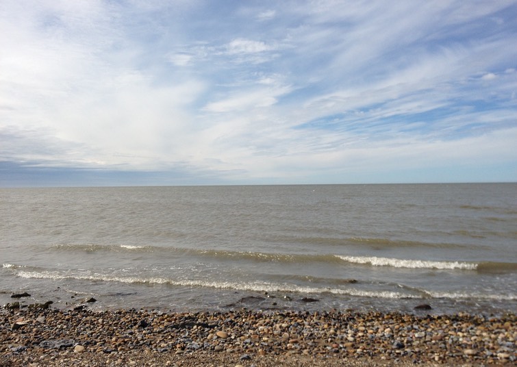
On the Marge of Lake LeBarge
In the gold rush days, we would have taken ship for Alaska and steamed our way up the Yukon to reach Whitehorse. This time, we took the plane, and even that was a bit of an adventure, as low-lying clouds almost prevented us from landing. We made it in the end, however, and found ourselves a world away.
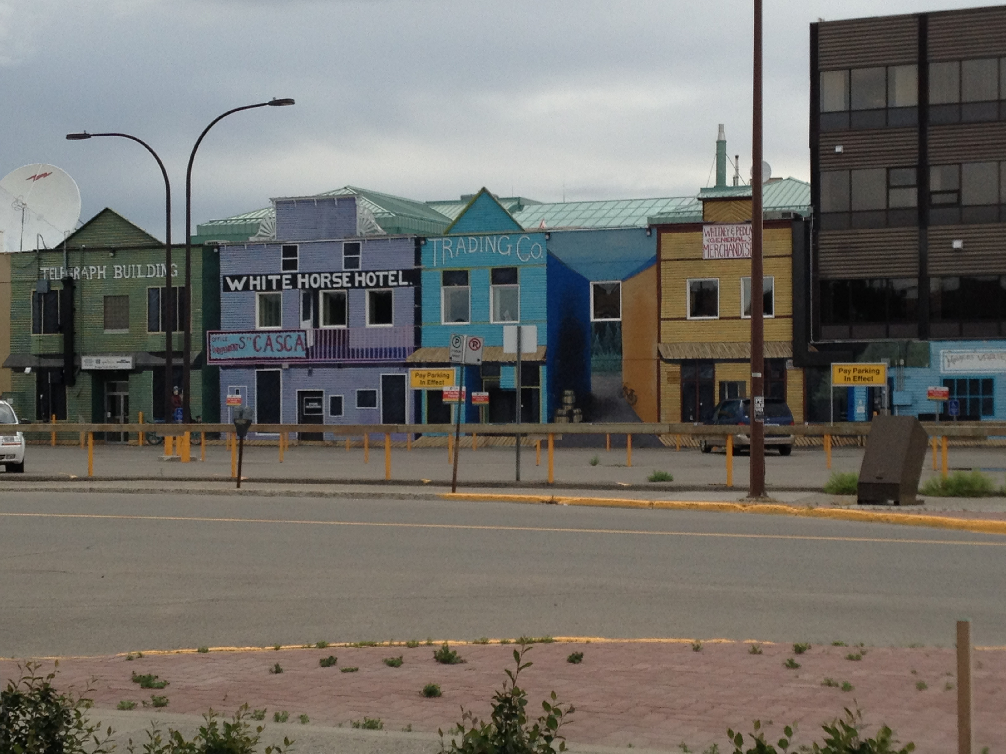
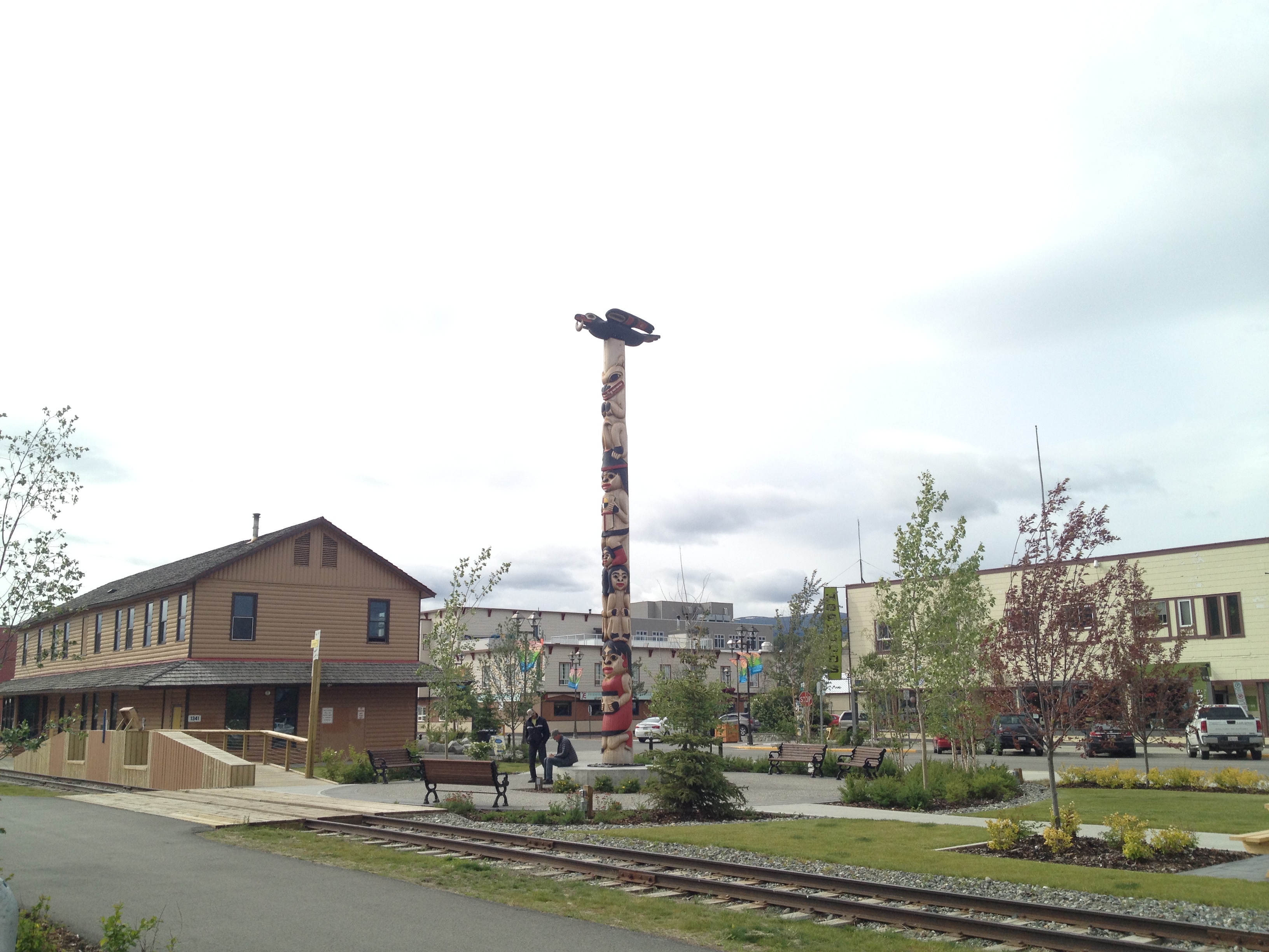
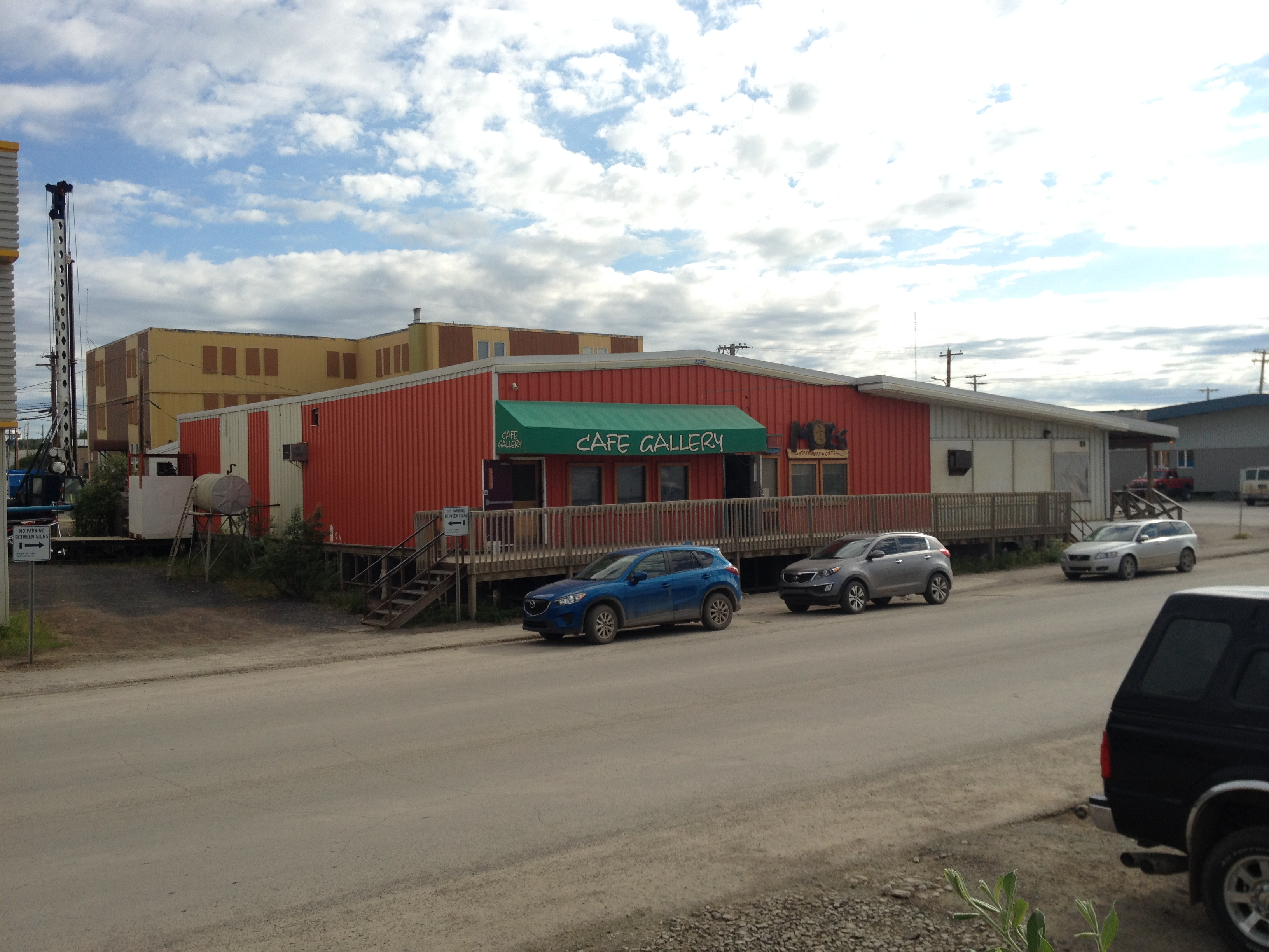
The city of Whitehorse sits on the banks of the famous Yukon River. It is a town with ties to Jack London, Robert Service, and the historic Yukon Gold Rush, but it is small and undramatic, lacking the more colourful atmosphere of Dawson City. Upon arrival from the south, everything seems smaller- buildings, roads, the downtown area. But things also feel bigger- the forests, mountains, and distances that surround it. It is a workaday place, but still with a bit of wild west feeling to it- still a connection to its pioneer roots.
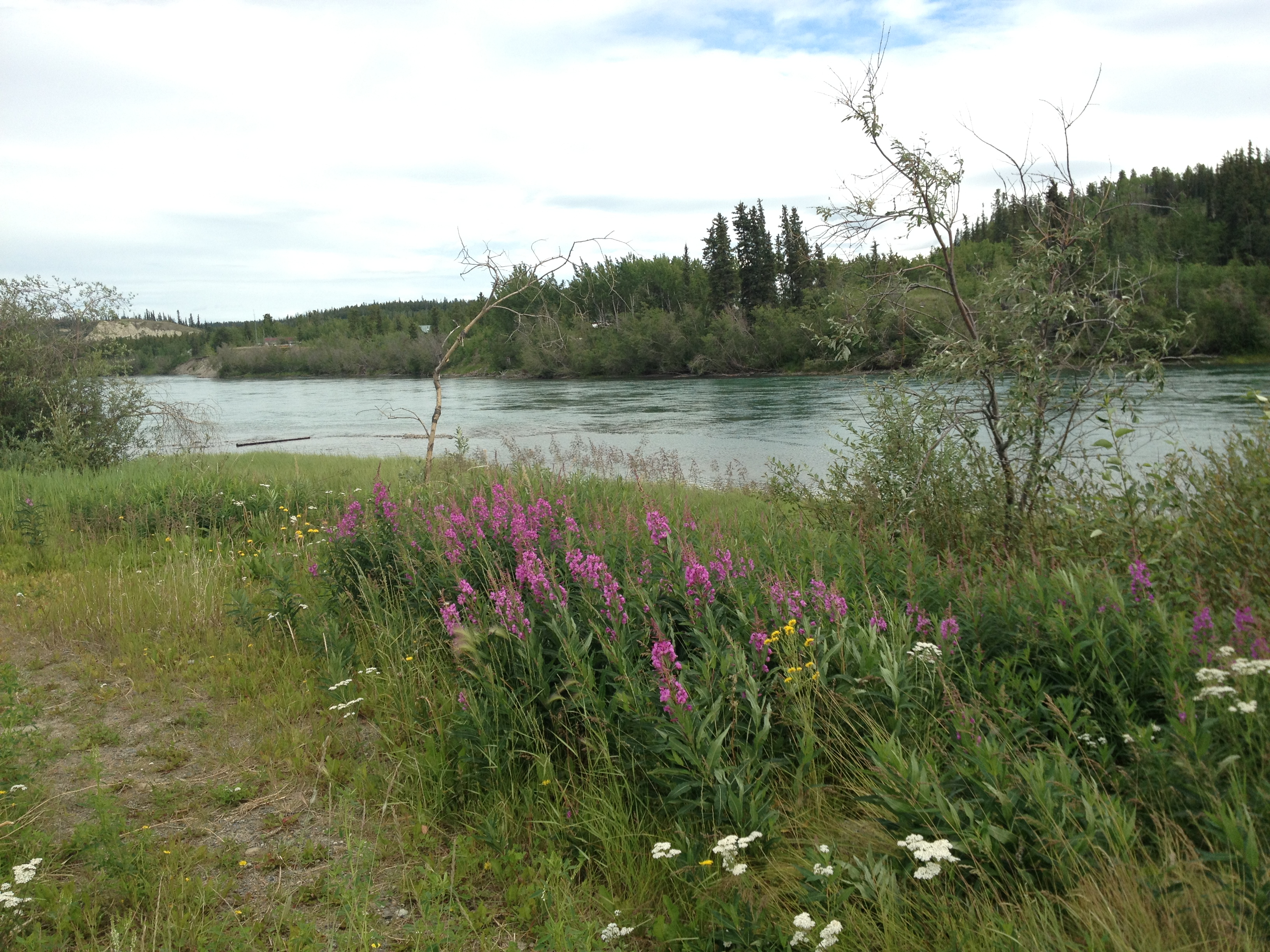
Our sightseeing in Whitehorse, as in Dawson, was done on our way back down from the Arctic. For the previous two days, every kilometre between Inuvik and Whitehorse had felt as though it turned the world a touch less exotic. And yet, it still feels very “northern” here, with multicoloured wildflowers in bloom all along the roadside, and the mountains rising around Lake Leberge. As we came near to Whitehorse, we saw a mom sitting in a lawn chair by an intersection, waiting for the school bus, and we realized that we were in the “suburbs”! Whitehorse felt very urban compared to where we had been. It was strange to be back in a city, even a small one, with paved sidewalks and traffic signals, where we were once again governed by what my husband called “the tyranny of the yellow line”!

There are some good places to eat, including a surprisingly fabulous Mexican restaurant (these are in short supply even in the larger cities in Canada). This was the real deal: there was only Mexican beer on the beer list, spicy meant spicy, and there were lots of vegetarian choices and virgin cocktails. Perfect. There are some nice art and souvenir shops, and there is a good selection of hotels in the downtown area (and even outside of downtown, nothing is too far away).
We enjoyed the historical museum, where we saw some historical artifacts of interest, including Sam McGee’s cabin. (The historical Sam McGee lived and worked for awhile in Whitehorse, but a short drive up the highway lies the famous “marge on Lake Lebarge” where his fictional counterpart was cremated.) We walked to the edge of downtown to visit the farmers’ market, where we bought some art from a friendly local woman, who was also selling kale (always best to diversify!). There is a very pretty walking path along the river that we followed back into downtown, enjoying the grasses and wildflowers, and beautiful views of the Yukon. The town would make an enjoyable base from which to explore the beauties of the surrounding Yukon.
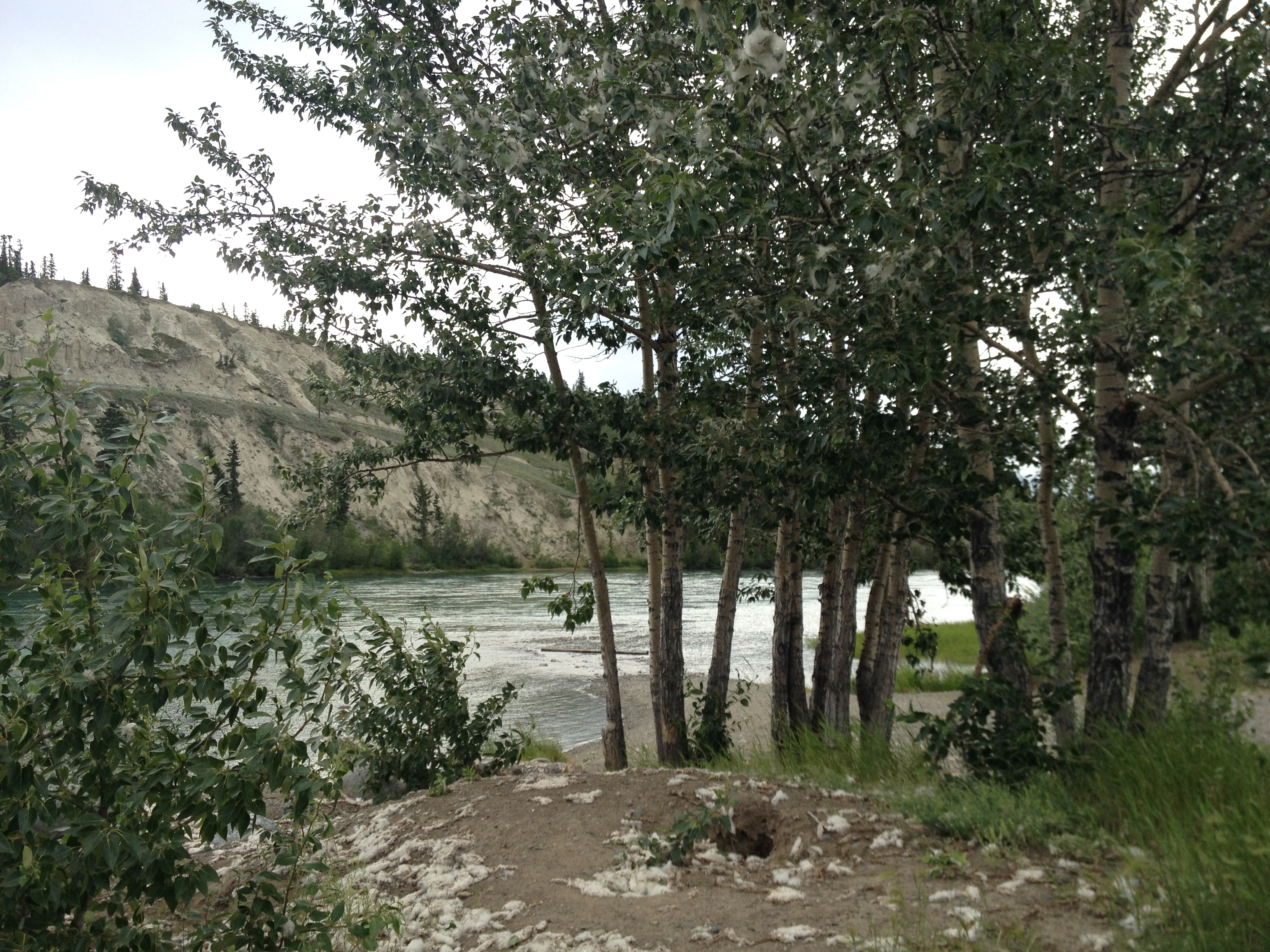
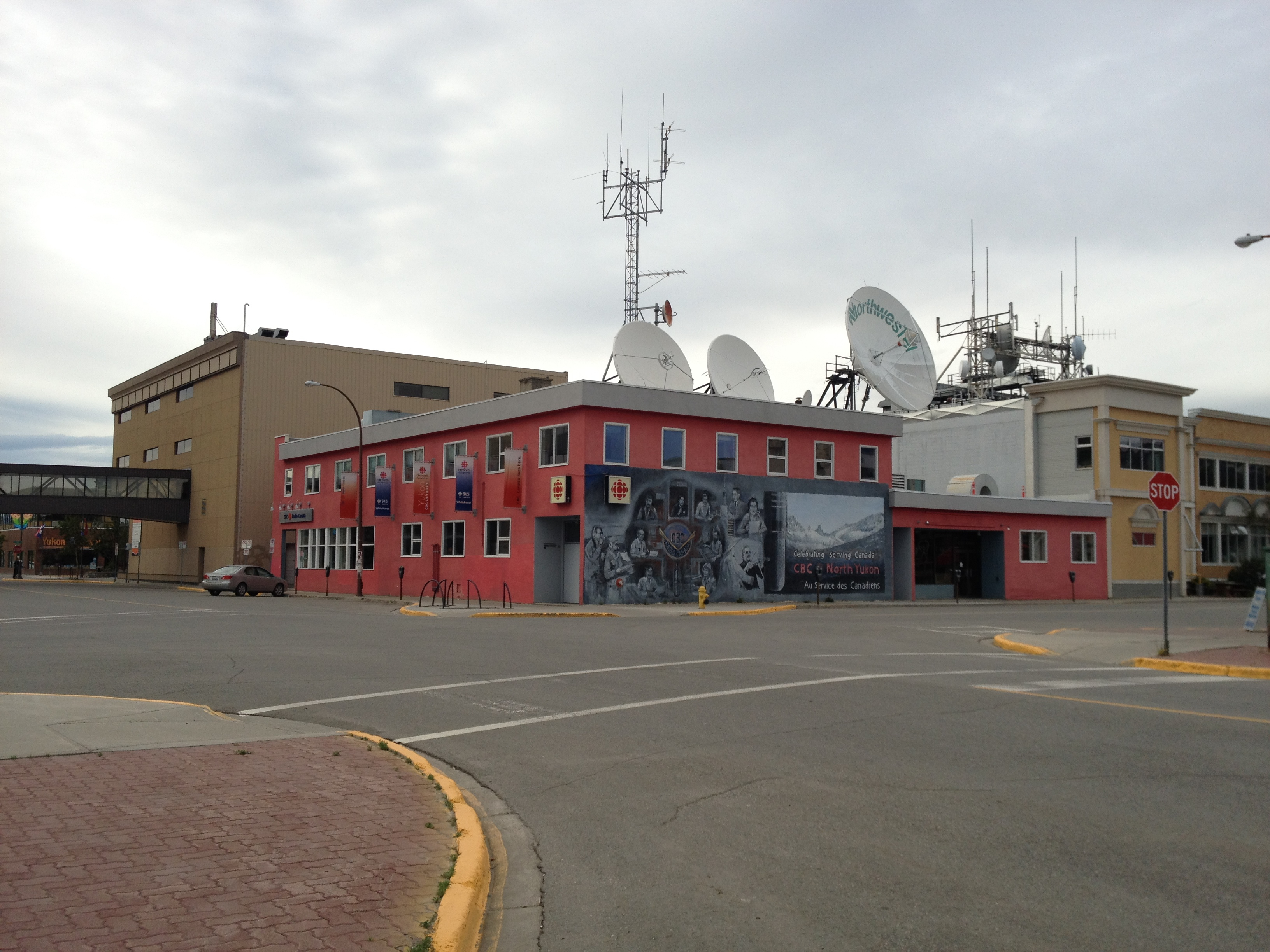
Photos: Wildflowers along the Yukon; Whitehorse waterfront; vintage-style buildings downtown; CBC broadcast building; Mexican cantina; cottonwoods by the river (Photo 2 B. Wilkes; photo 5 N. Wilkes)
Reaching for the Beaufort Sea
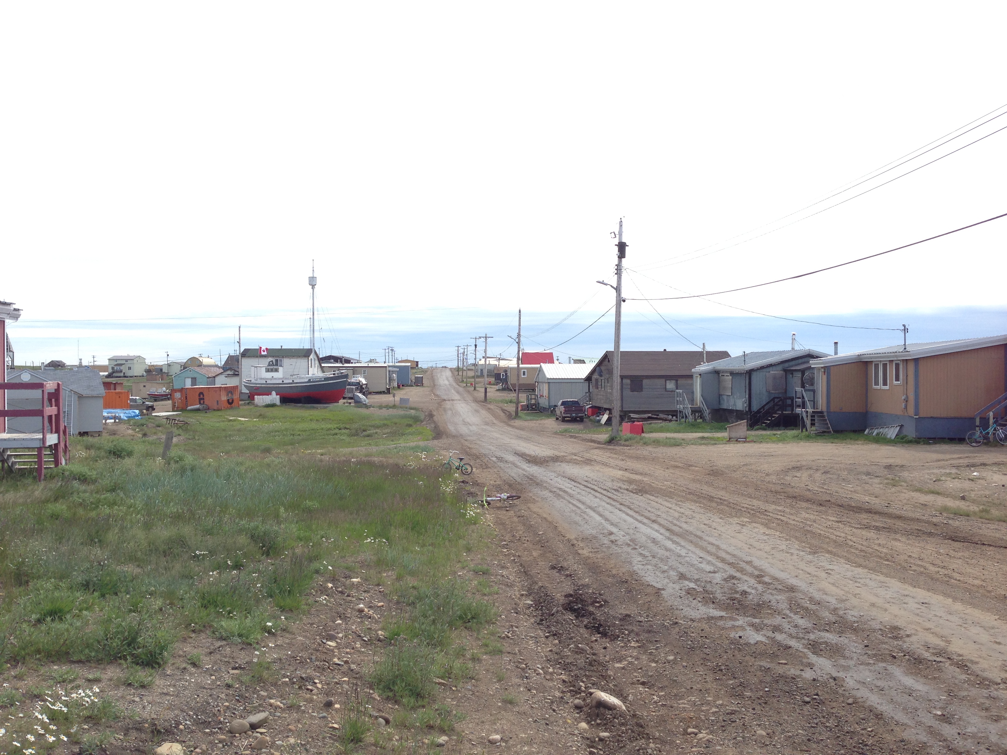

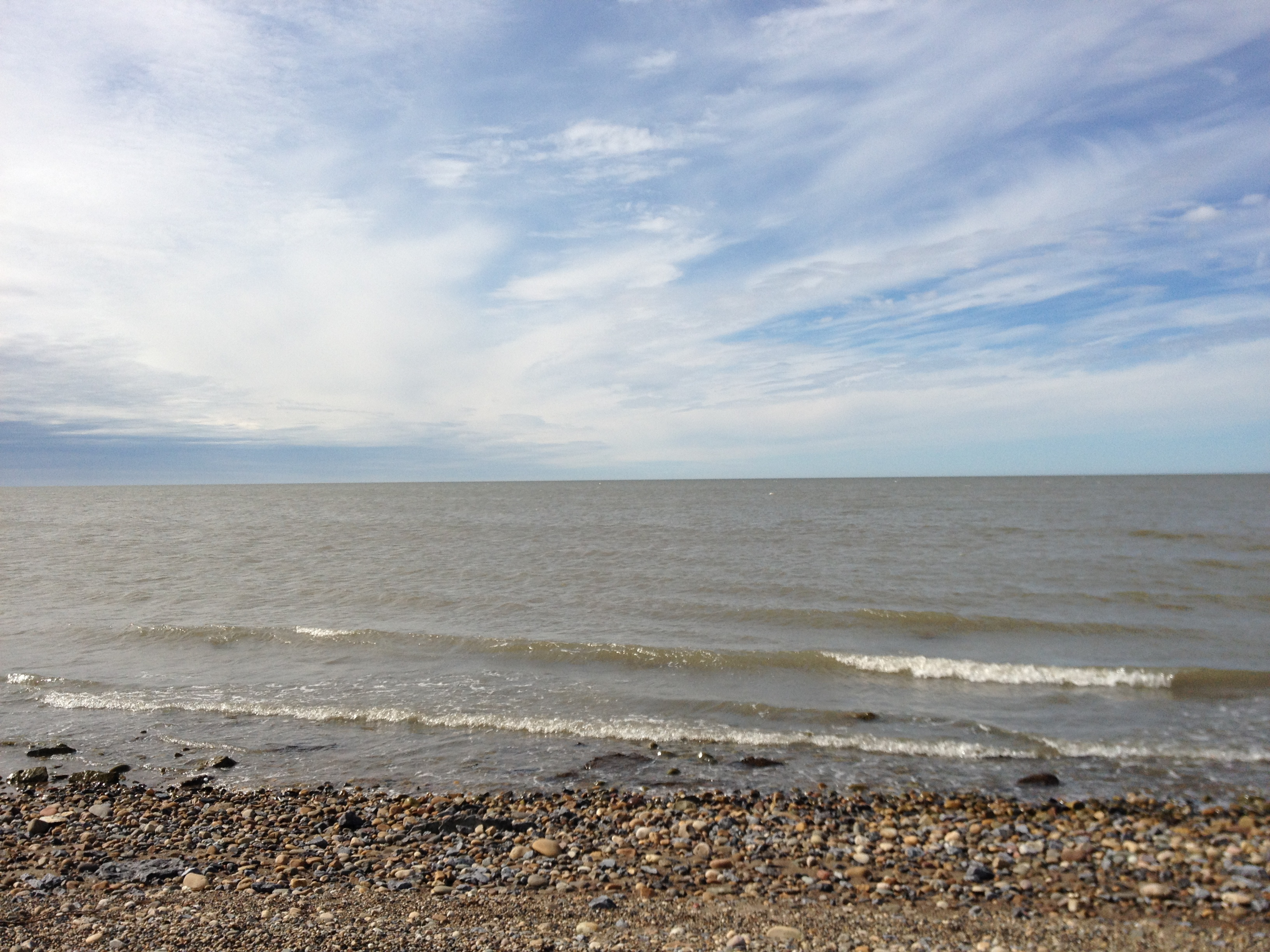
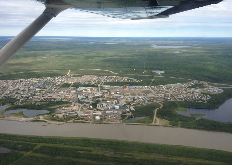
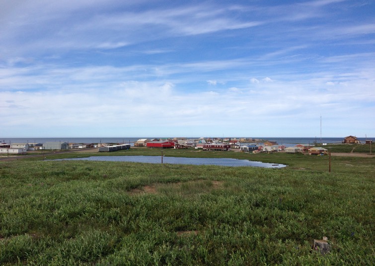
During the entirety of our Arctic adventure, we were inescapably haunted by the words and melody of Stan Rogers’ ode to the north, “Northwest Passage”, and at no time more than the afternoon we spent in Tuktoyaktuk, on the edge of the Beaufort Sea. An extension to the Dempster Highway is currently under construction, built into the permafrost; but for now, summer visitors still fly across the delta in small commercial planes or charters. We went in a Cessna 172 piloted by a young man from Ontario who is enjoying adventure in the arctic while getting his flying hours in.
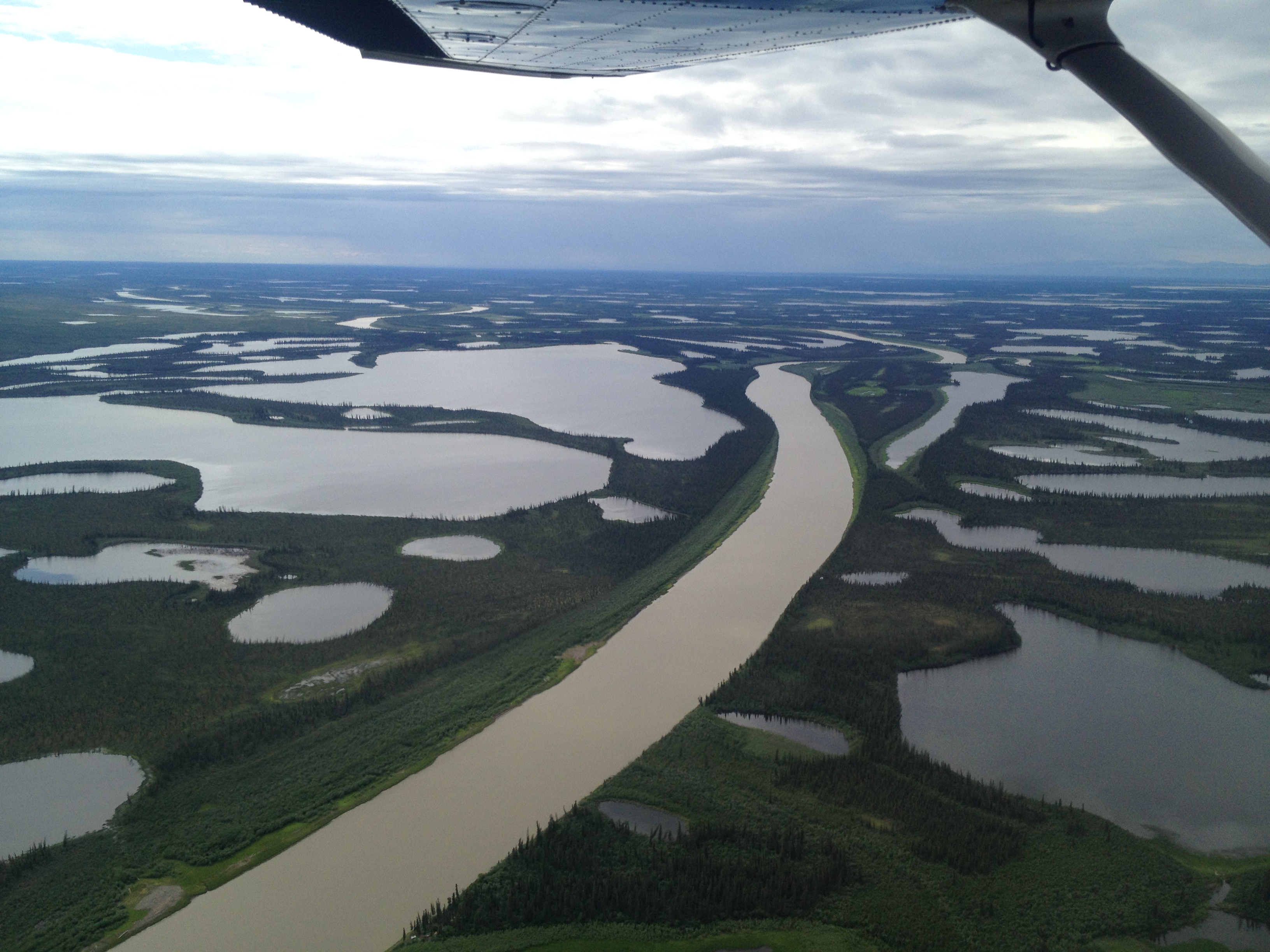
The exhilaration of the trip is overwhelming, even if you are, as I am, distinctly nervous in small planes. You get stunning views of the delta and surrounding tundra, including the famous “pingoes”, humps in the ground pushed up by the permafrost. The sight of that massive plain broken up by water is unforgettable.
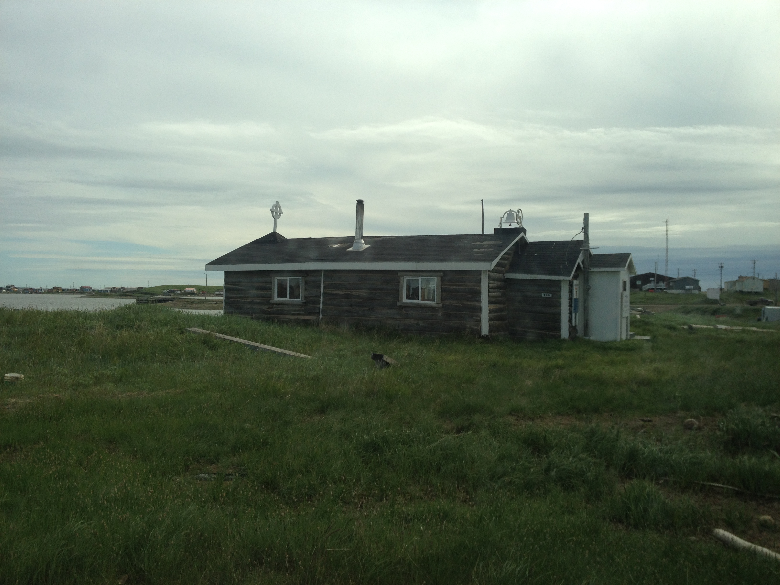
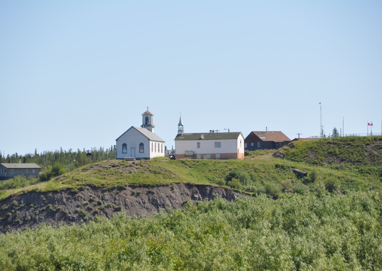
A typical tour around the predominantly-Inuit hamlet is run by a chatty local guide. My memories of our visit twenty years ago and the young man who showed us around the community then, sharing anecdotes about himself and his neighbours (he pointed out one of the churches and mentioning that the minister “was wondering where I was this morning”), were not dimmed by our guide on this occasion. She pointed out both the giant pingo (“the biggest in North America”) and the satellite dishes (“for our HD TV and our high speed Internet”). She showed us the little Catholic church, where there used to be a Father, but he recently died, so now there is a Nun, and “I see she has her satellite dish in already”!
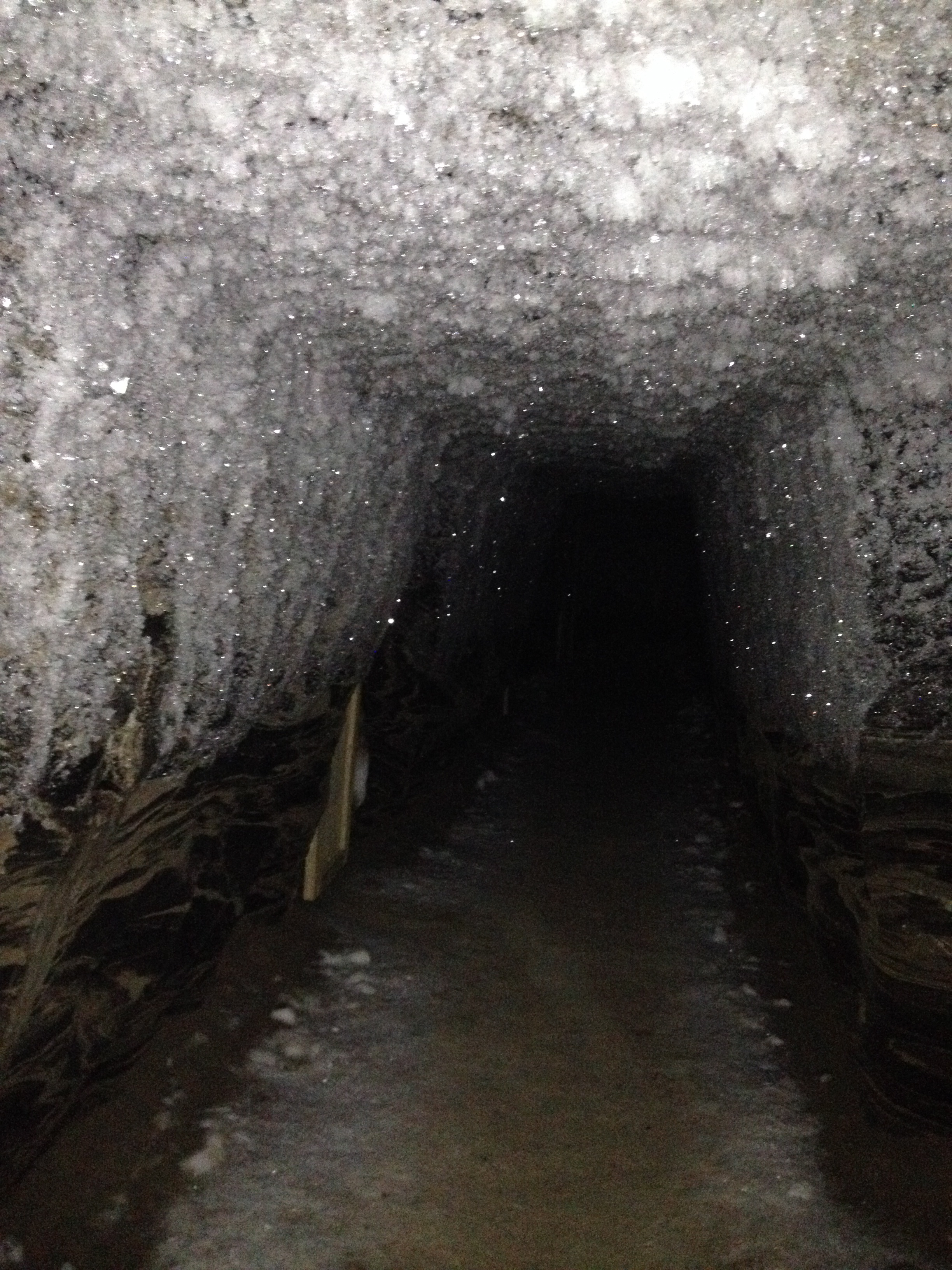
Many of the inhabitants still earn some or most of their living by hunting, trapping, and fishing. We were taken down into the community freezer, thirty feet down a slippery wooden ladder into the permafrost. This was both scary and a bit smelly, but fascinating all the same, to see the walls sparkling like a fabulous diamond mine all around the little wooden doors that led to each person’s meat locker. Finally, our guide took us back to her home, where we met her husband and visited their tent, in which they had on display the skins of various animals they had trapped.
It’s a fascinating glimpse of a tiny community (population sits somewhere around 800) perched on the edge of the habitable world. Its culture is a strange combination of the traditional (subsistence living, community activities) and the modern (satellite TV, cell phones, snowmobiles). Its people are isolated in the ways of their ancestors, and yet connected to the rest of the world in much the same way as are we all.
Ah, for just one time, I would take the Northwest Passage,
to find the hand of Franklin reaching for the Beaufort Sea.
Tracing one warm line through a land so wild and savage,
and make a northwest passage to the sea.
– Stan Rogers
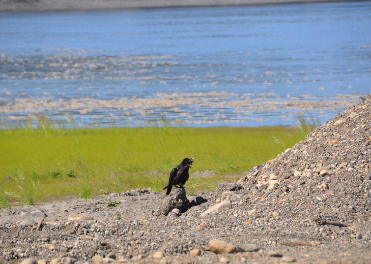
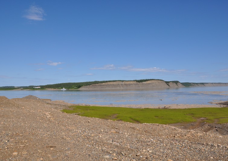
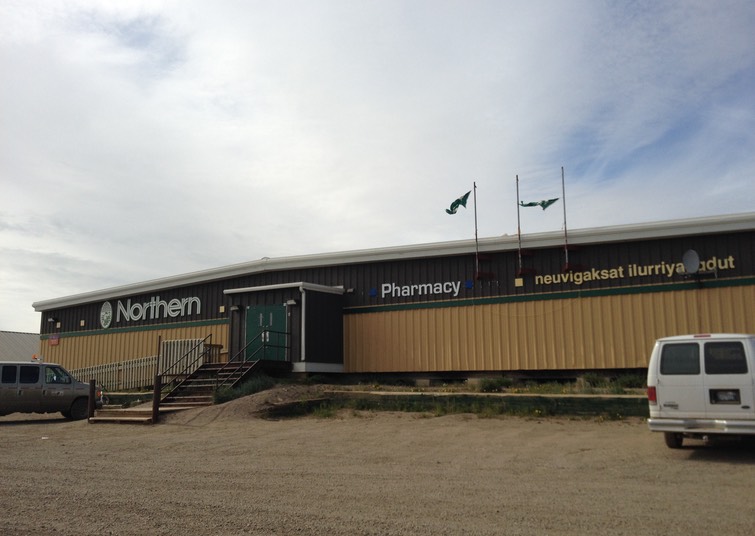
Photos: Tuktoyaktuk’s main street; the Northern Store; the Mckenzie Delta; Anglican Church; community freezer; the Beaufort Sea (Photo 1 N. Wilkes; photo 3 B. Wilkes)
Northern Exposure
Our recollections of Inuvik from our stay twenty years ago include camping in the snow (despite visiting in June!), the strange sight of the midnight sun as it dips down toward the horizon and circles back up again, and a distinct lack of any food for vegetarians (fortunately, we still ate fish in those days, so we dined out on Arctic char and fish and chips). There were, I believe, only two hotels; one of them, the Eskimo Inn, provided us with a bed for the one night we could afford, as well as a nice dinner (it was our first wedding anniversary).
Nowadays, there are a few more amenities. We stayed in a newish hotel designed for corporate clients, with a kitchenette so that we could cook our meals, and air conditioning because this time around, the weather was more typical for the time of year. We shopped at a sizeable grocery store, where we were able to get the fixings for pasta and bean burritos. There is now a beautiful visitor centre, built not long after our last visit, where we were able to get information about local artists and things to do and see. There is also a great café, run by really lovely people, where you can get espresso and chai drinks, smoothies, and great breakfast treats in a nice atmosphere.
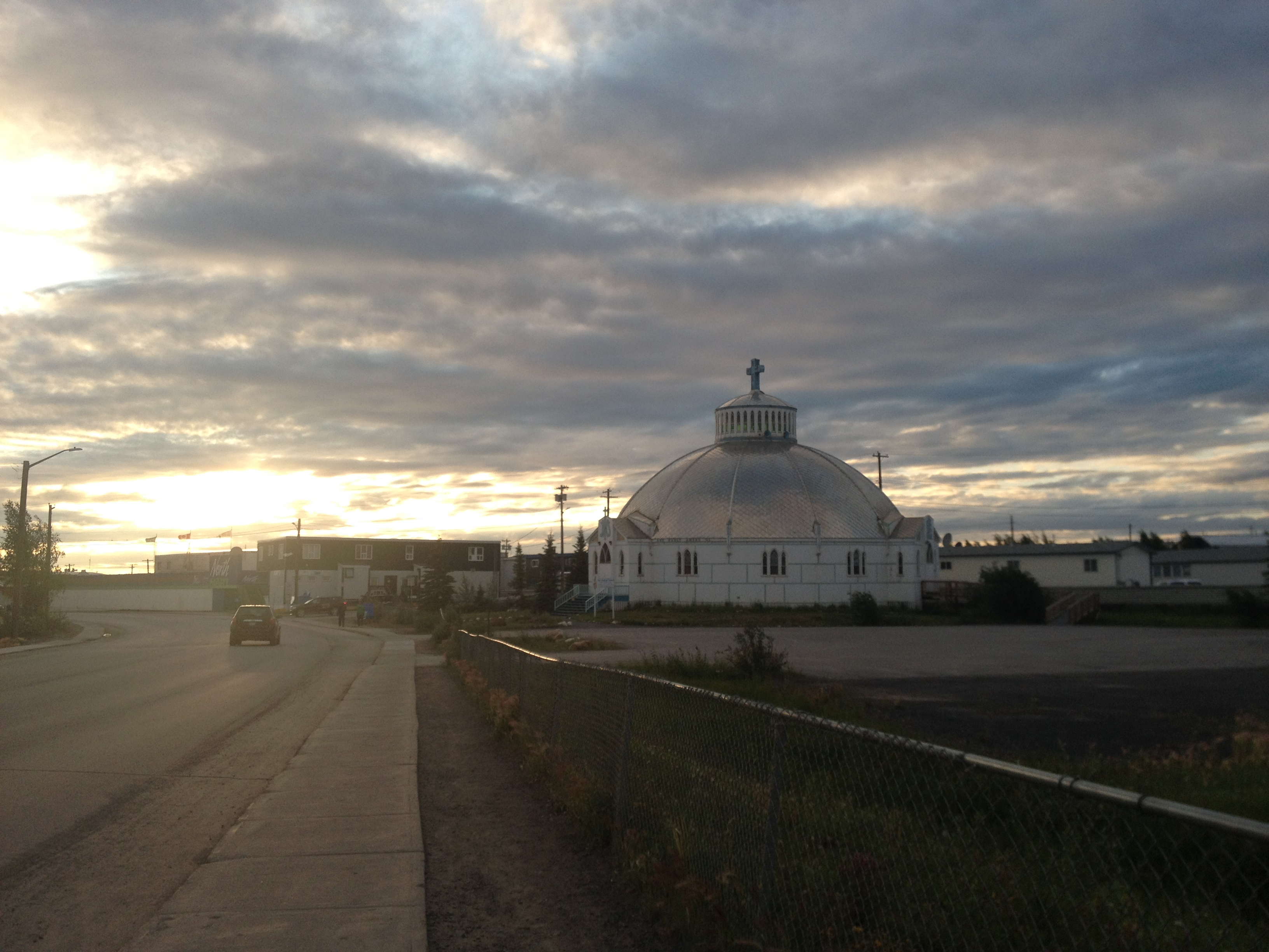
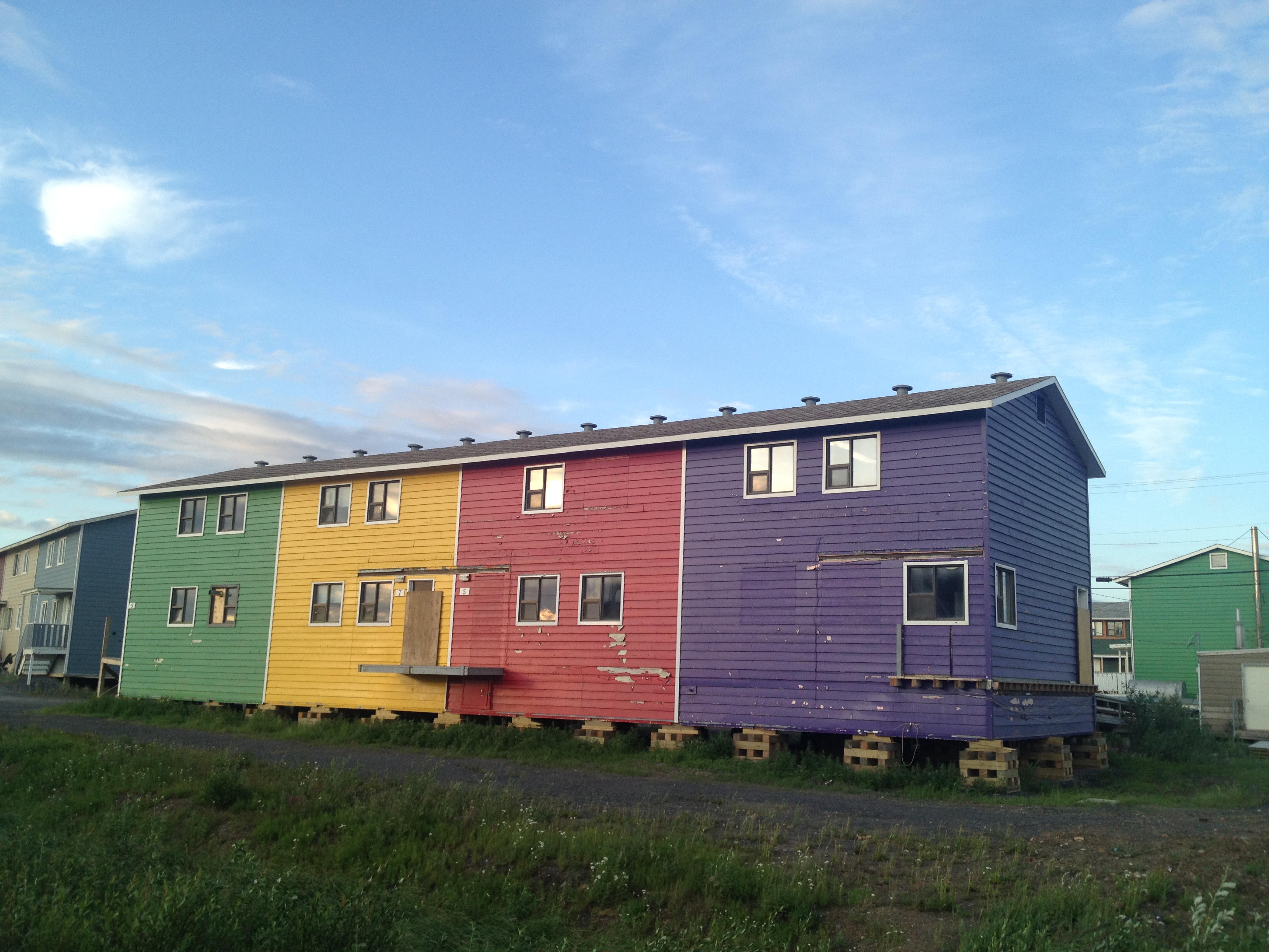
However, there is still the unique Igloo Church, and the Arctic Esso, and the brightly-coloured houses set up on stilts above the permafrost. The sewers and water pipes run above ground, a network of metal running behind and alongside the buildings. There is still the midnight sun, and the sight of young kids out playing on scooters at one in the morning.
And there are still the friendly and interesting people living in this Arctic frontier town. The residents are Inuit, white, and Gwich’in, with a scattering of others (including a small but growing Muslim community). We encountered people of all ages and characters in the liquor store (picking up a wide variety of purchases!), all ready with a nod or a hello. The people in the little shops we visited, in the tourist centre, and in the café, were all very welcoming. We were happy to be able to spend some money in their community and get to know 21st-century Inuvik, which feels somewhat more modern than the last time we visited, but with the essential character unchanged: part frontier town and part small town anywhere.
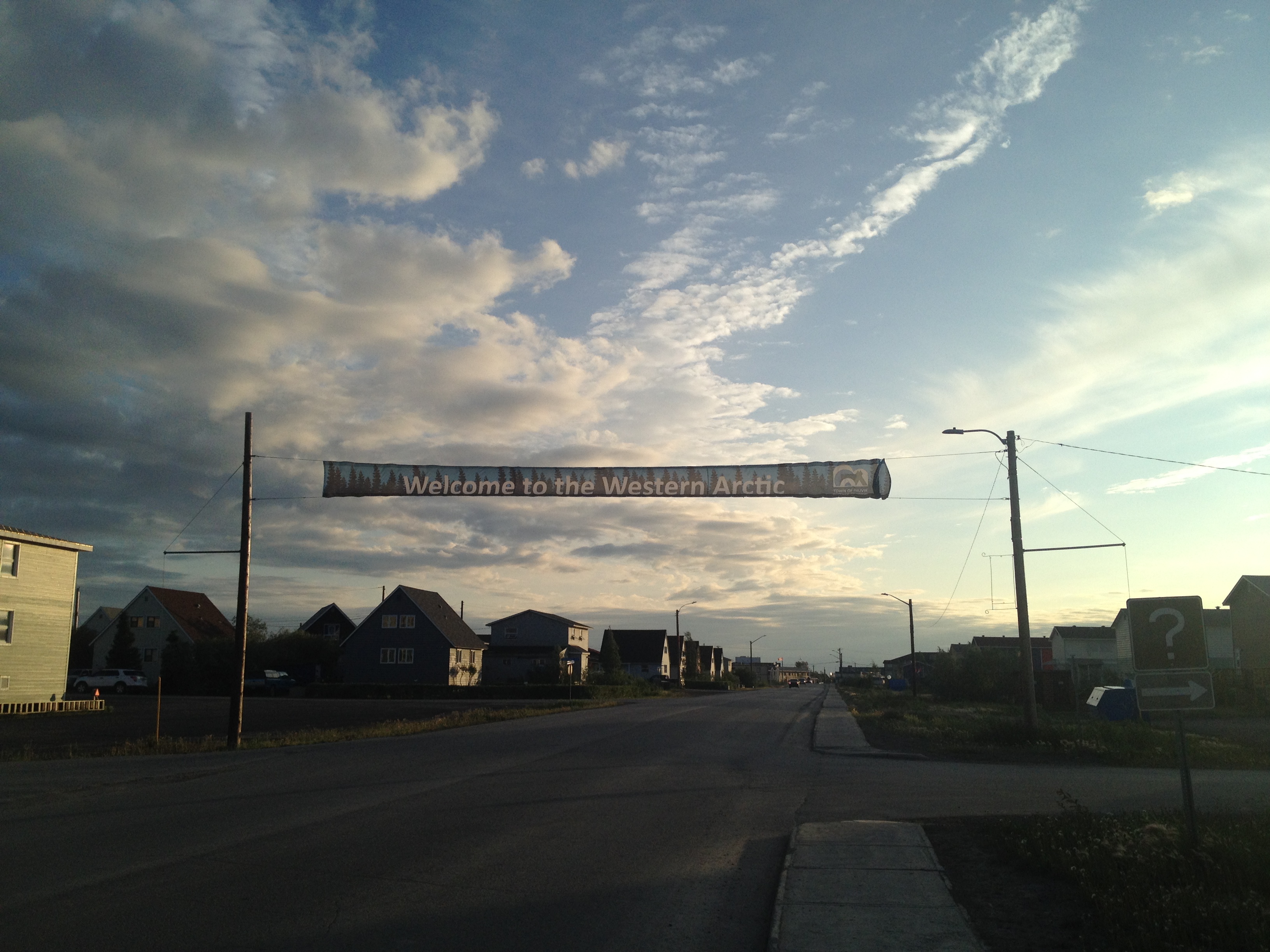
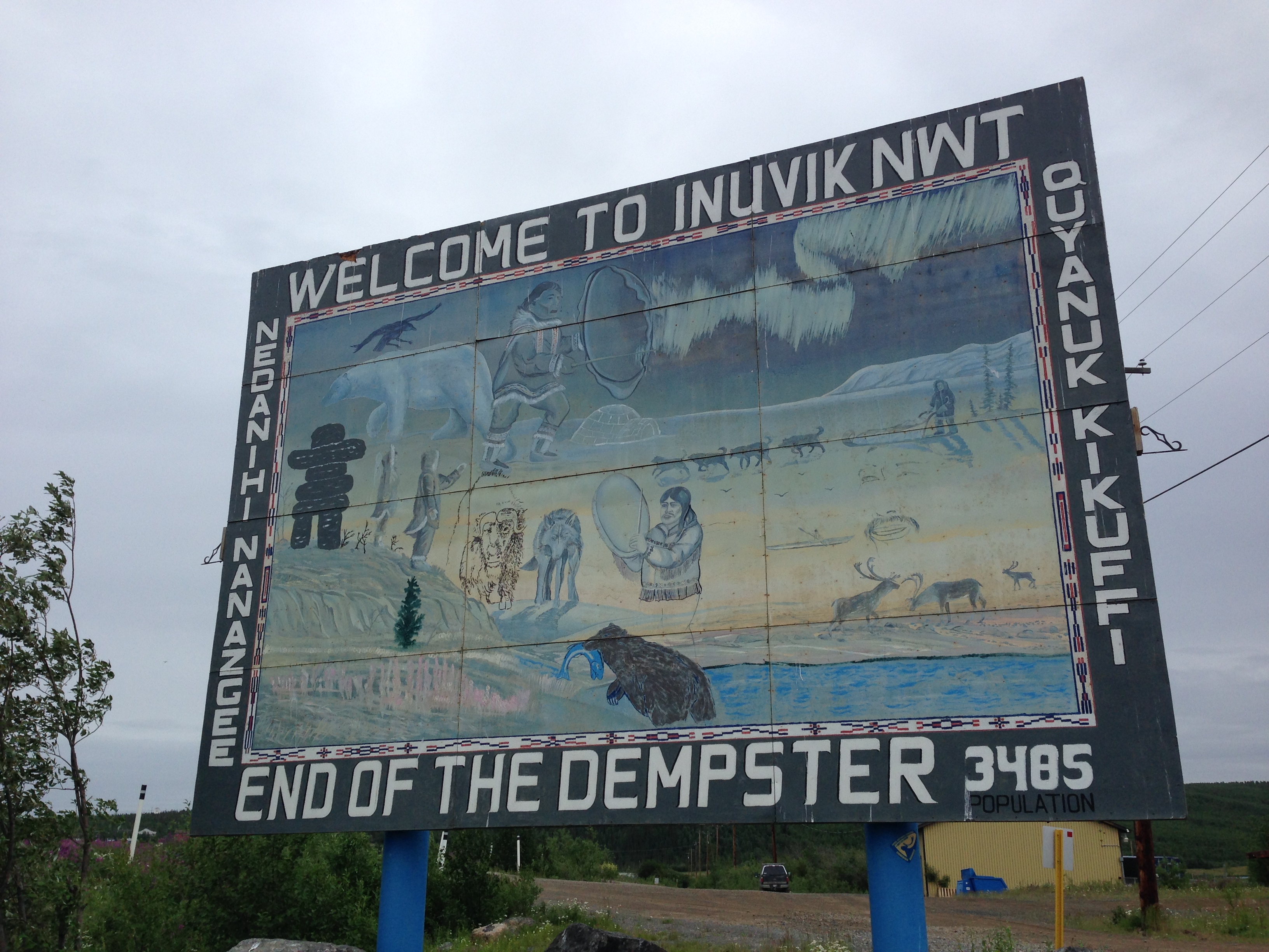
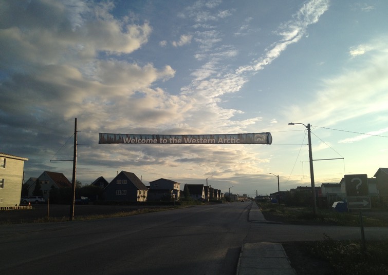
Photos: McKenzie Road, Inuvik’s main street; historic welcome sign; café downtown; Igloo Church at midnight; raised houses (Photos 1,5 B. Wilkes; photo 2 N. Wilkes)
Yukon Ho!
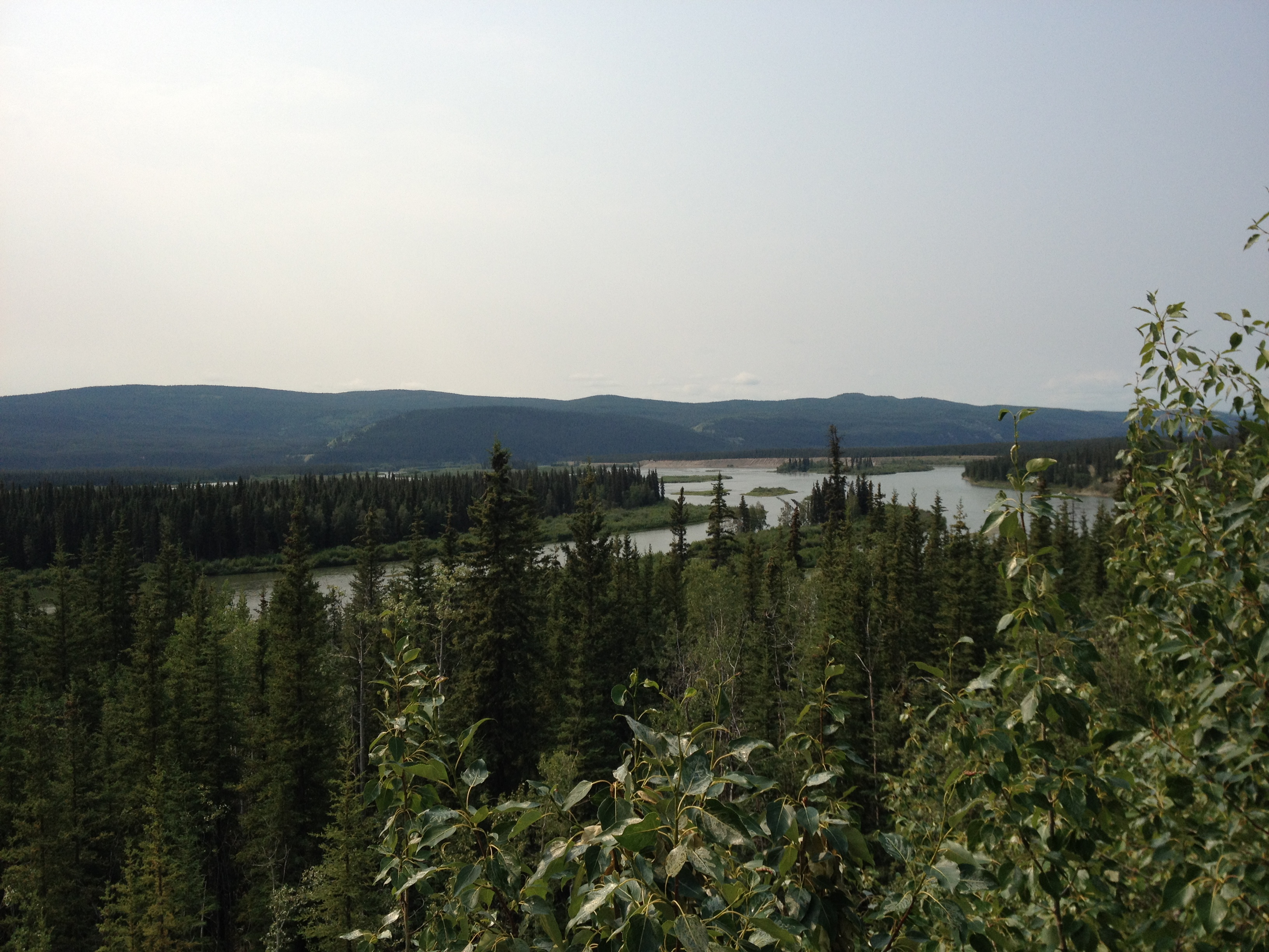
The drive between Whitehorse and Dawson City along Yukon’s Highway 2, the Klondike Highway, is littered with iconic place names– the Yukon River, Lake Leberge, the Klondike– and winds its way through northern forests of birch and black pine, past rivers and lakes. We made the trip in a very easy day of driving, but at the remains of Montague House, a one-time stagecoach stop, we learned about the stagecoaches that once carried people along the route throughout the winter, taking on average about five days!
Throughout our drive, we frequently sought information from The Book– not the Hitchhiker’s Guide to the Galaxy, but the Milepost, the Bible of the North. Without it, we would not have known for whom all the little rivers and lakes we passed were named, or the population of Carmacks (444) or Pelly Crossing (296), or that one of the World Famous Cinnamon Buns from the Braeburn Lodge will feed four people. I spent the day with The Book in my lap, and referred to it continually.
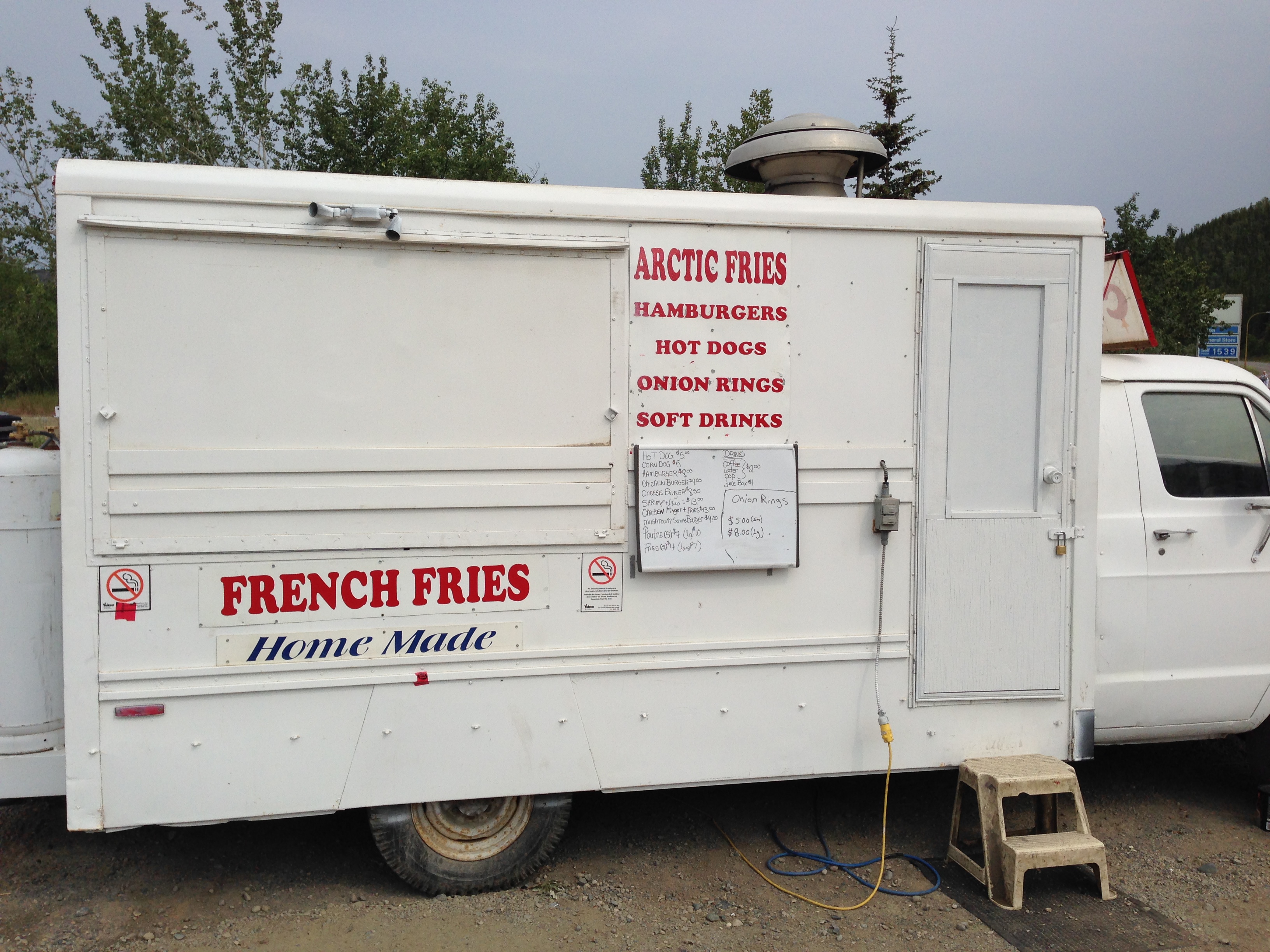
We stopped at the historic village of Carmacks (population 444; see above), where the highway rejoined the Yukon River. There was a great little pit stop at a shop in an old RCMP barracks, run by a friendly woman who sold homemade ice cream floats and milkshakes. (This woman would recognize us on our return a few days later, and ask us about our trip, as she had never gone up the Dempster herself.) We travelled alongside or across numerous rivers throughout the day– the Yukon, the Pelly, the Stewart, and eventually the famed Klondike. It felt momentous enough to us; I could imagine how the prospectors must have felt after long travels through the wilderness to get there.
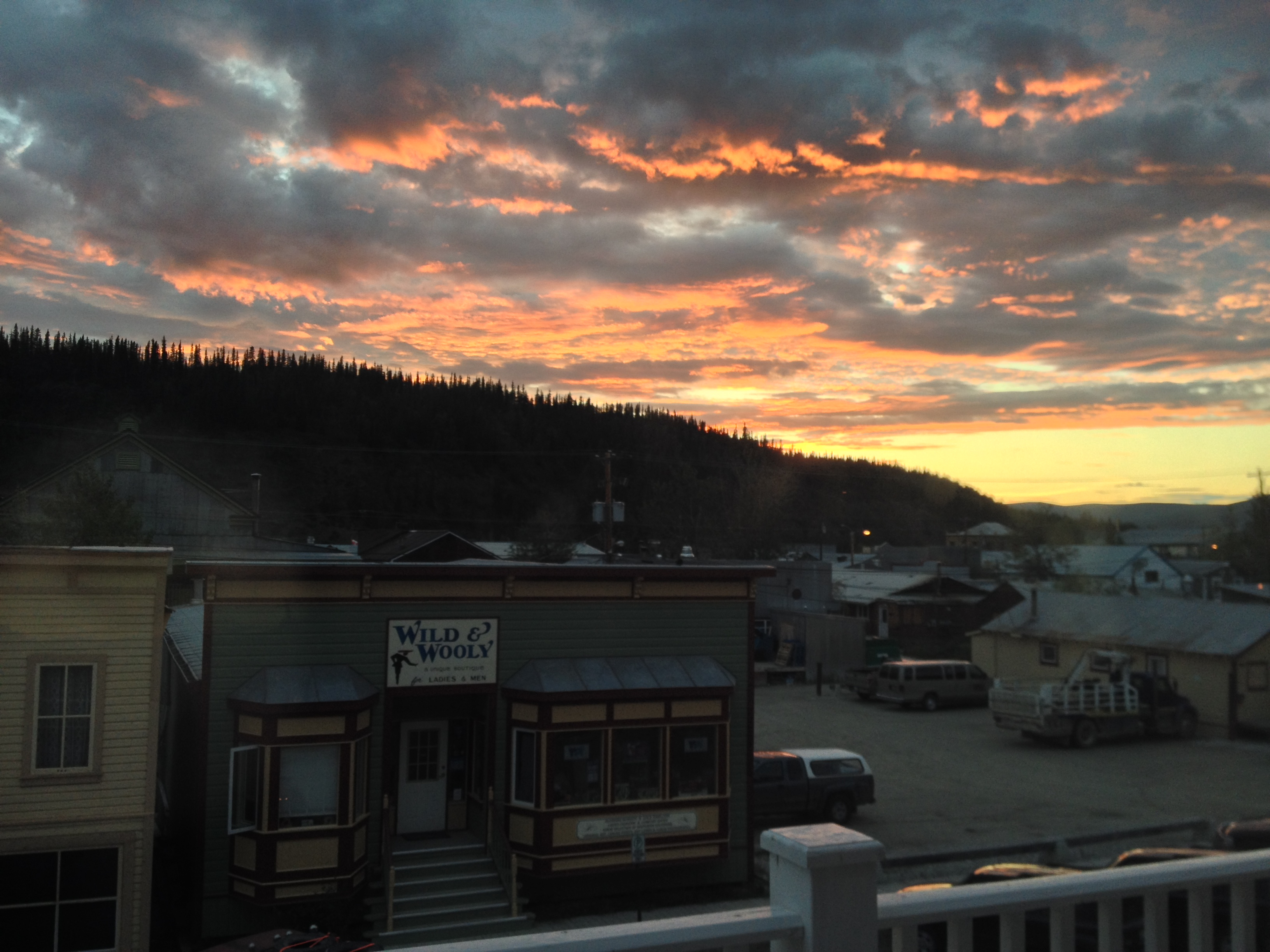
We passed the entrance to the Dempster Highway, to which we would be returning the next day. For now, a nice dinner and hotel awaited us in Dawson City. We followed the Klondike to its confluence with the Yukon, where the town sits between the two. We had Greek food for dinner and wandered around the boardwalk-edged streets, but the majority of our time in Dawson was spent after our adventures in the High Arctic, on our way back down to Whitehorse.
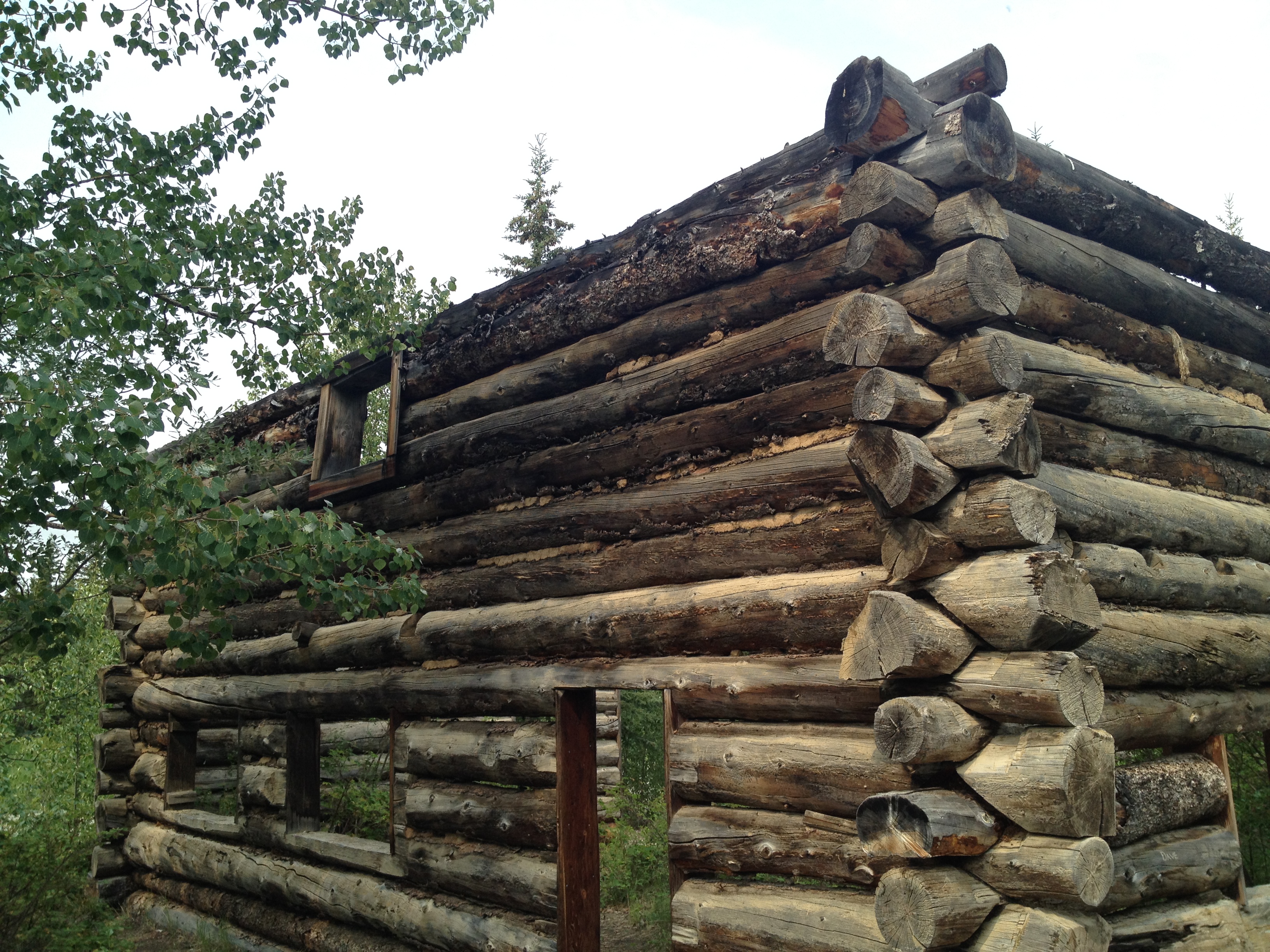
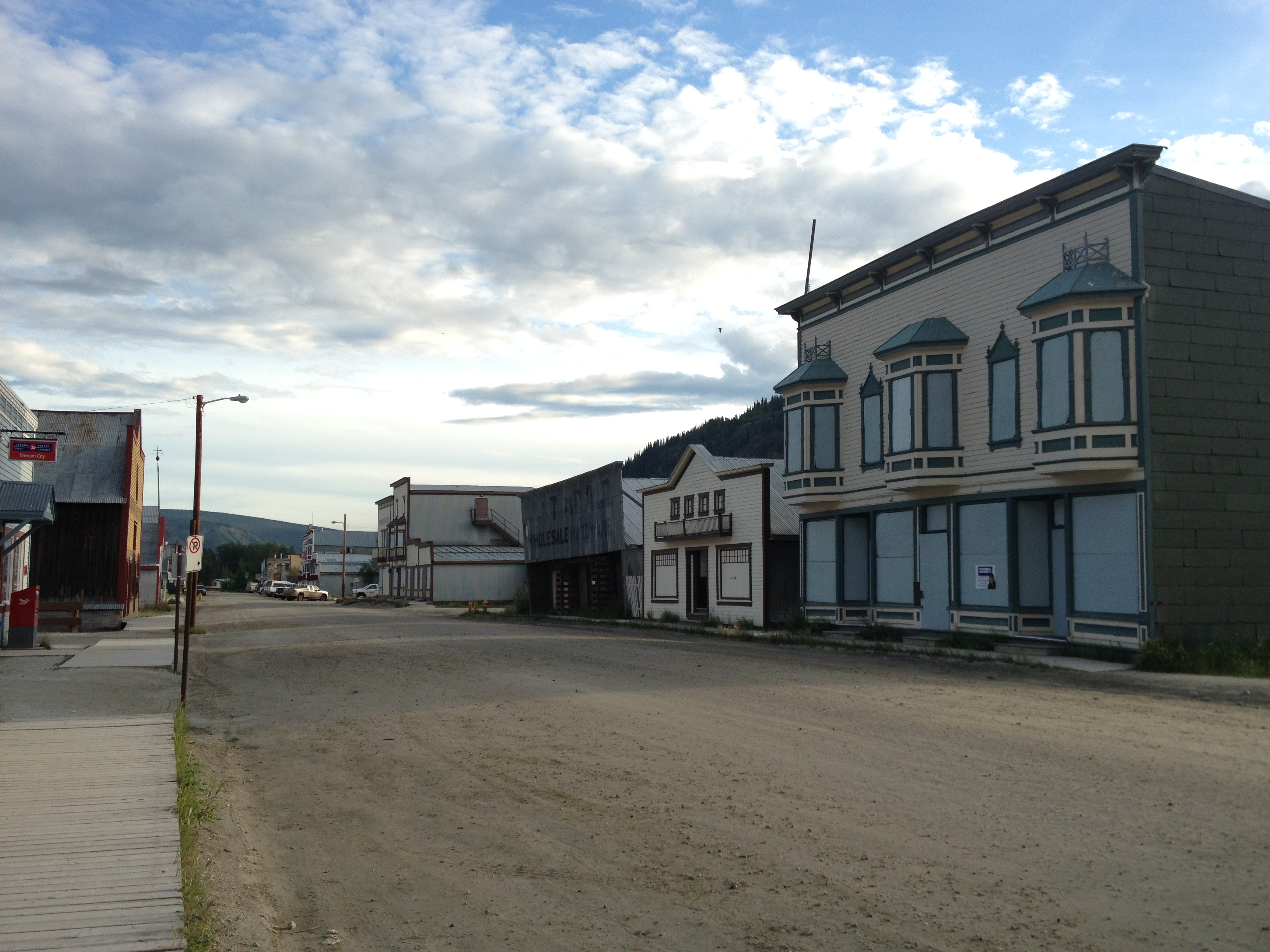
Dawson City is of course an iconic gold rush town, and it has not forgotten its history (or the reason so many tourists visit here). The streets are dirt, the sidewalks plank, and the buildings are a combination of actual historic structures and modern versions of the same, complete with colourful false fronts and swinging saloon doors. There are sufficient shops, galleries, and decent restaurants scattered around town to provide a solid couple of days’ amusement, along with an excellent museum filled with details about the gold rush and the history of the town. You can also visit the cabin in which the poet Robert Service lived; we stopped by briefly for a photo op on our way out of town, and had to wait until a highly unromantic woman with a vacuum cleaner had left the porch!
There is a nice walk along the riverfront, and while the sun does set here in July (unlike in the high Arctic), it doesn’t happen until around 11:30, which must have been an astonishing thing for the gold hunters from California in the old days.
We spent part of our full Dawson day on a divergent road trip to the Alaska border, along the stunning Top of the World Highway. To get to the highway (and to the border), you have to cross the Yukon River on a ferry. Twenty years ago, we camped out at Dawson, at a nice campground on the far side (we had come from there), and at that time it was pretty much a drive-up-and-drive-on experience. Not so nowadays, when a daily traffic jam of RV’s lines up every morning on both sides of the river (mostly tourists from Alaska). Some of these vehicles must wait half the day, as the ferry is small and only takes a few large vehicles at a time. Luckily for us, however, they were sandwiching smaller vehicles in with the big ones, and there were far fewer cars, so we got across right away.
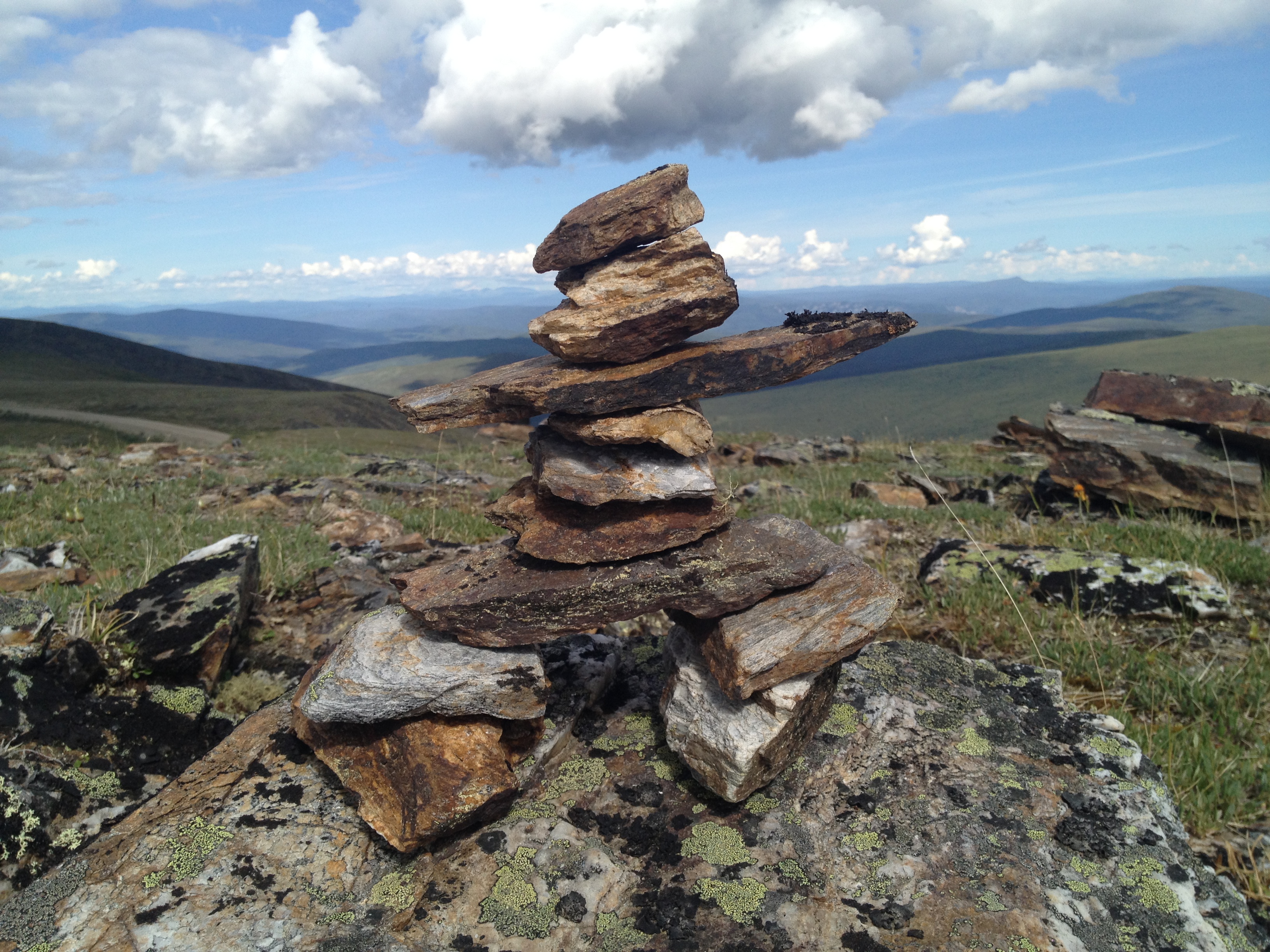
The sun was shining over the amazing vistas that I still remembered from twenty years ago. The sense of space is hard to describe, as hill after hill rolls away from the highway into the distance in both directions. We stood at a roadside marker, looking out at the view and singing Imagine Dragons’ catchy song, “I’m On Top of the World.” (It couldn’t be helped!) Coming down the Dempster the previous day, we had encountered an intrepid motorcyclist, and we saw him again today, taking pictures of flowers and looking like he was having a great time. In the hills above tiny, remote border crossing, we took a mini hike through the stony terrain to look at the views, and added an inukshuk to a collection of them that people had left behind.
It was a lovely, stress-free drive with no goal other than to get there and back, and look at the some of the most beautiful views we have ever seen.
Photos: the Yukon River; Montague House; french fry truck in Carmacks; Dawson City; Robert Service’s cabin; sunset over Dawson City; view from the Top of the World Highway; Canada-U.S. border crossing; inukshuk (Photos 2, 5, 8 B. Wilkes; photo 3 N. Wilkes)
Into the Arctic
The last frontier still exists. It isn’t necessary to travel to outer Mongolia, or the Amazon, or subsaharan Africa, to experience it. All that is necessary is a commercial flight to Whitehorse, Yukon, and a rental car. After that, all you need to do is drive north. Dawson City, the “hub” of northern Yukon, is visited during the summer by many people- RVers from Alaska, tour buses from the Alaskan cruise ships, and visitors from southern Canada. But remarkably few take the trip to its northern conclusion; remarkably few tackle the Dempster.
The unpaved highway stretches north from Dawson, passing into the Northwest Territories and across the Arctic Circle, over mighty river systems and through northern mountain ranges, and concluding (for now, at least) at the town of Inuvik. This is one of the most spectacular drives you will ever take, and every Canadian should do it. Sadly, only a tiny few ever will.
We have been fortunate enough to do the drive twice: the first time, twenty years ago, newly married, adventurous, and naïve; the second this year, equipped with teenage son, plenty of money, and a reliable and road-appropriate vehicle. I wouldn’t have missed either experience.
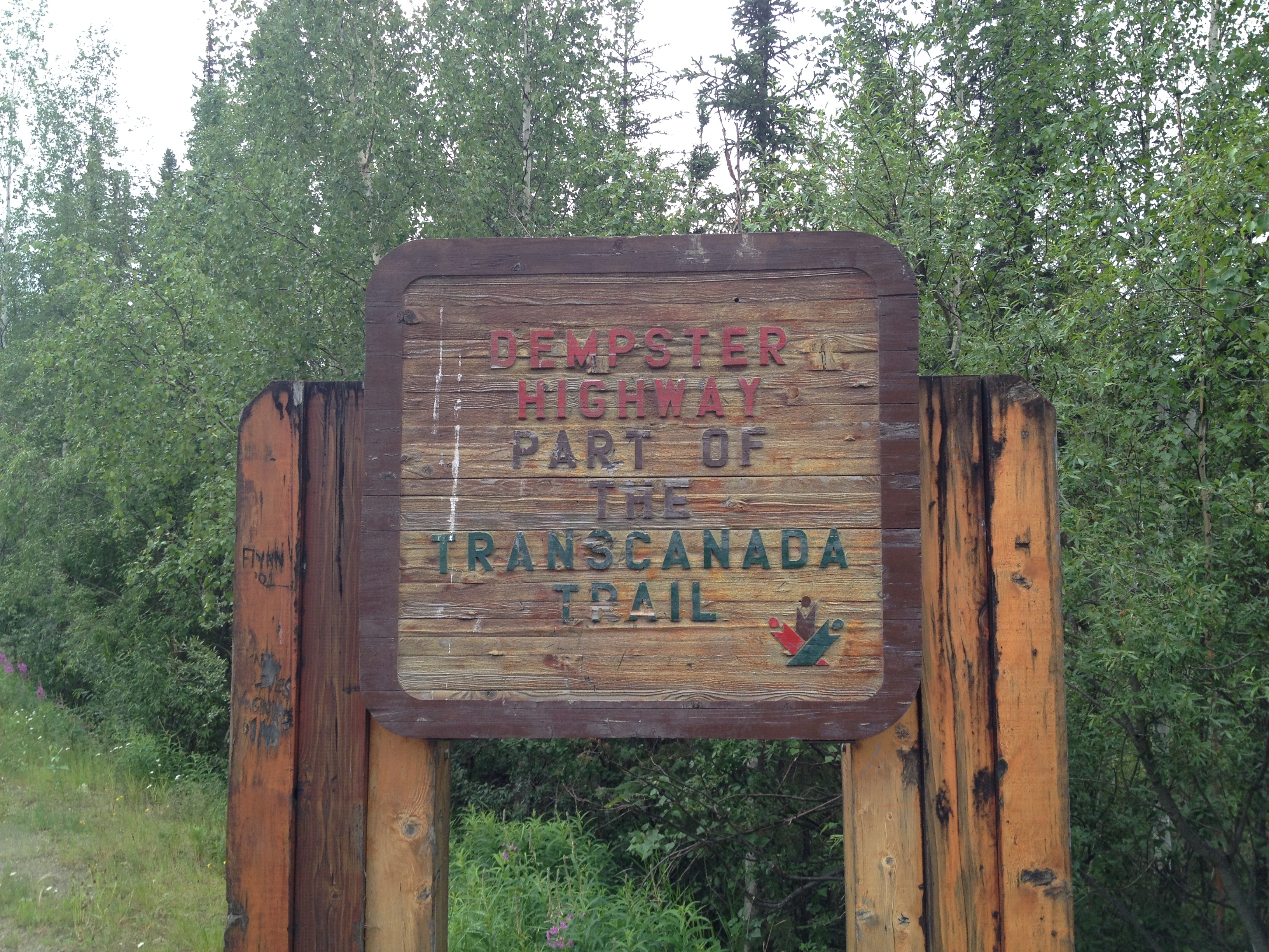
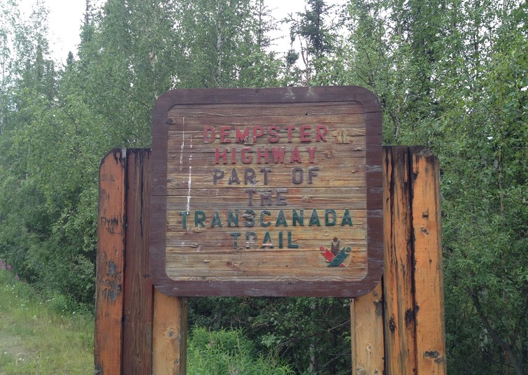
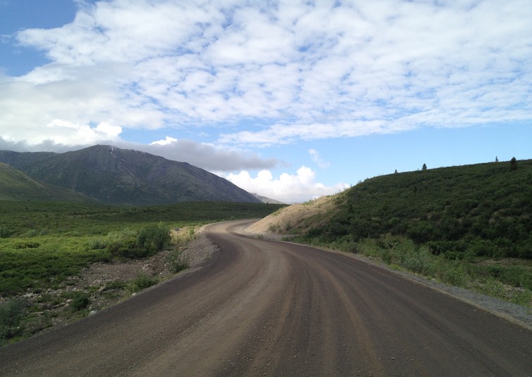
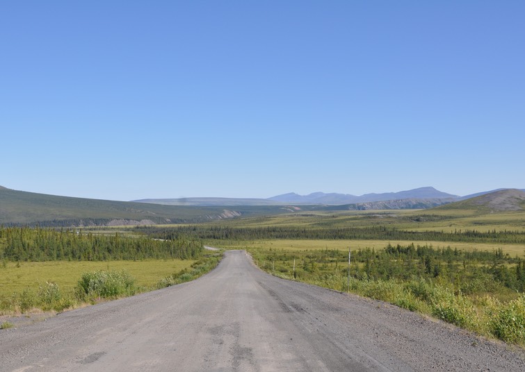
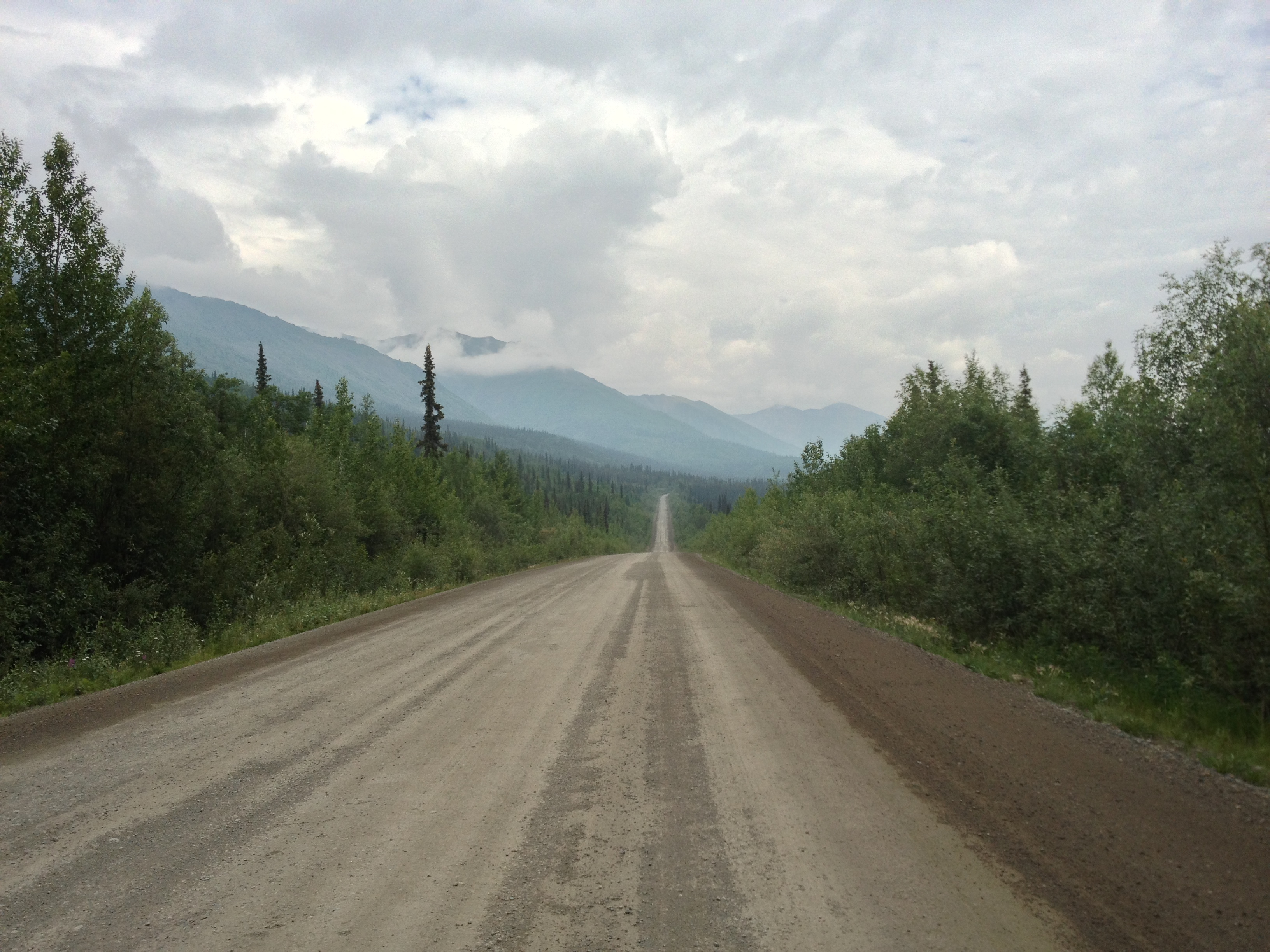
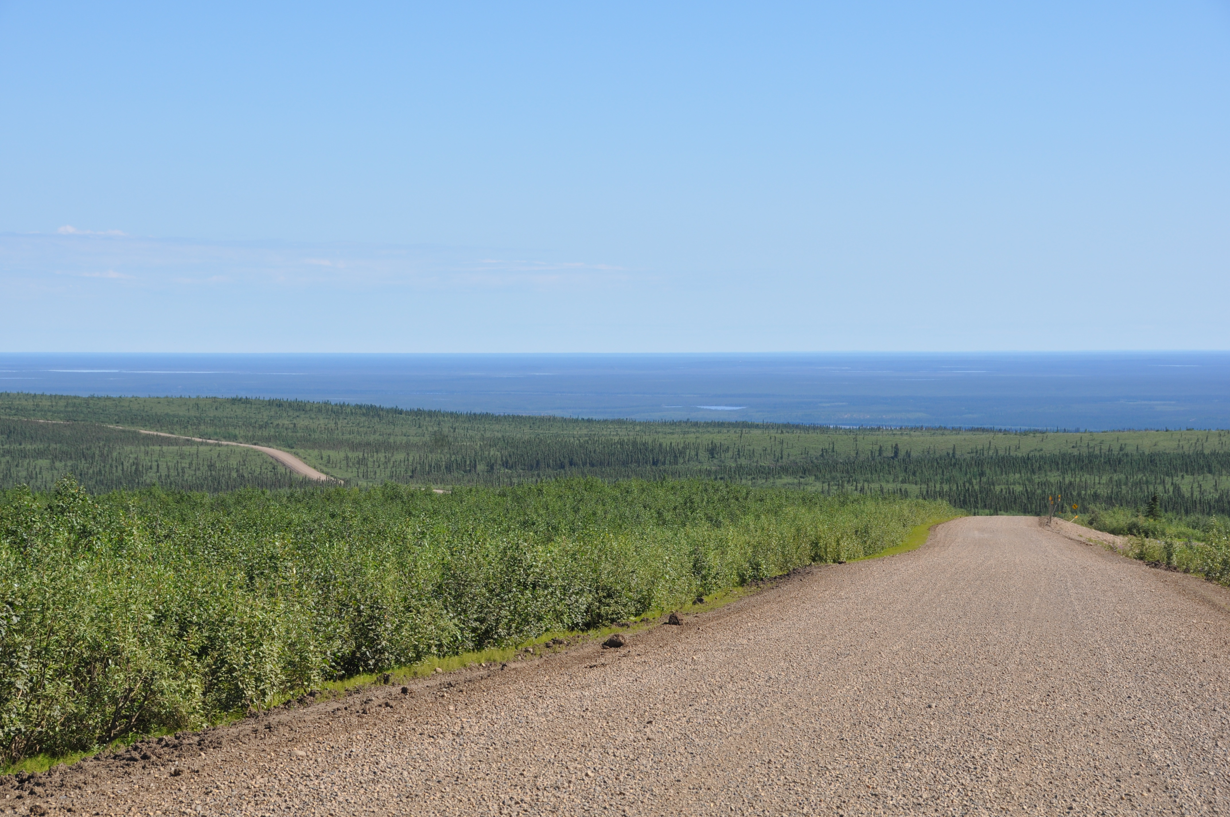
There is an instant magic when you turn off the highway outside of Dawson and cross the small bridge over the Klondike River, where a wooden sign proclaims the beginning of the adventure. After a few last metres of pavement, the car hits gravel and you are on your way. This narrow ribbon of unpaved road, currently winding its way along the bubbling Klondike through black spruce and willow shrubs, will take you through mountains, past plains, and over rivers, through tundra and taiga. You will see snow at some point along the way, and you will almost certainly experience rain and mud (if you don’t, you can hardly be said to have experienced the Dempster properly!).
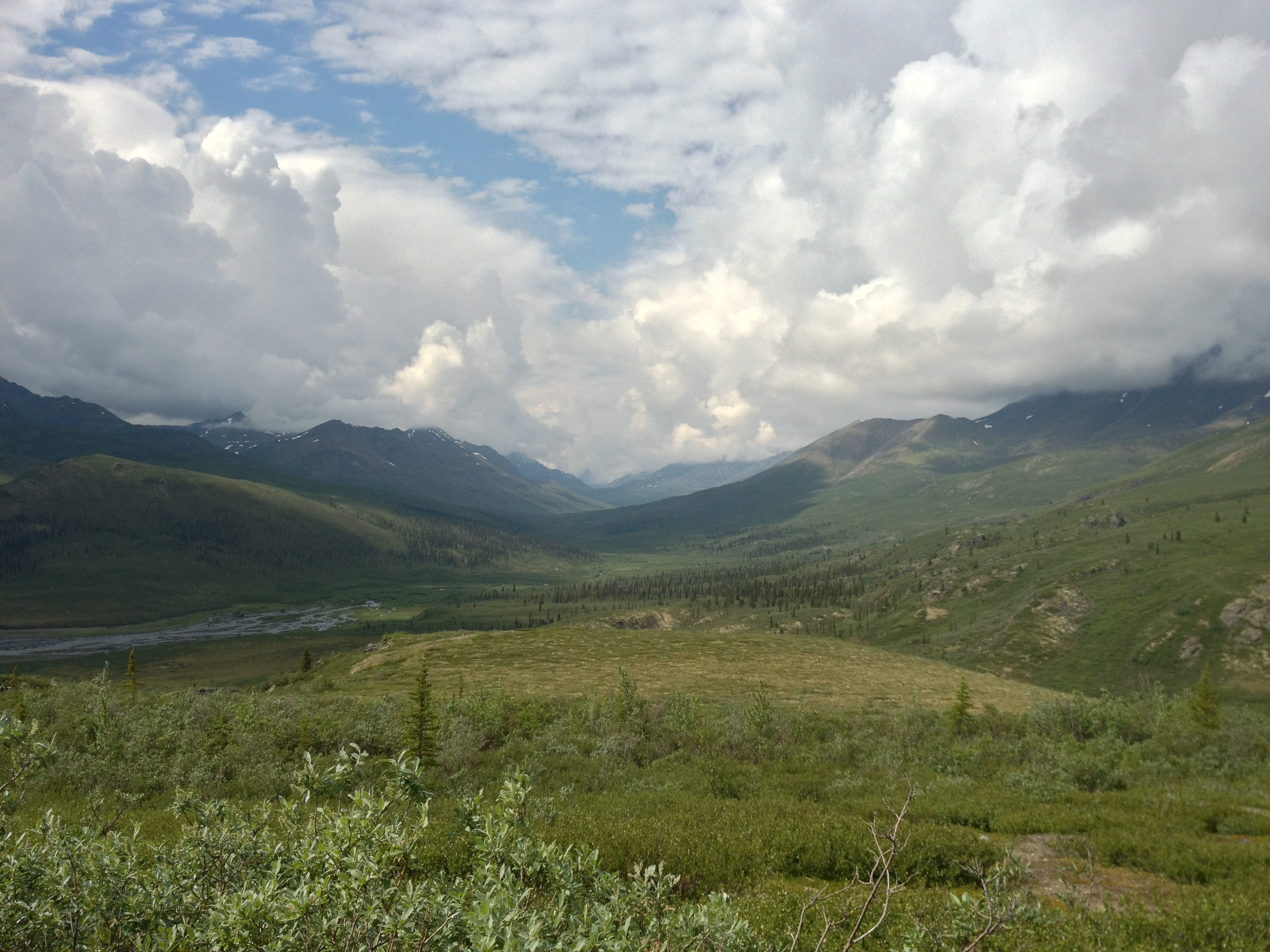
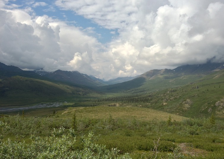
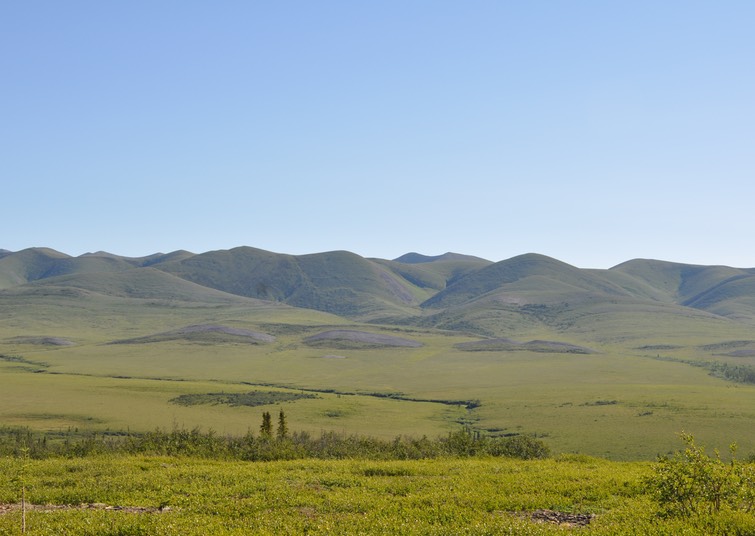
What you will not see in abundance is people. When you pull in for a rest stop, you will encounter a few fellow travellers, but even these become fewer once you have passed the interpretive centre at the Tombstone Territorial Park, which is an easy day trip from Dawson. The centre is relatively new and provides beautiful views out over the park, where a valley spreads back toward striking granite mountains.
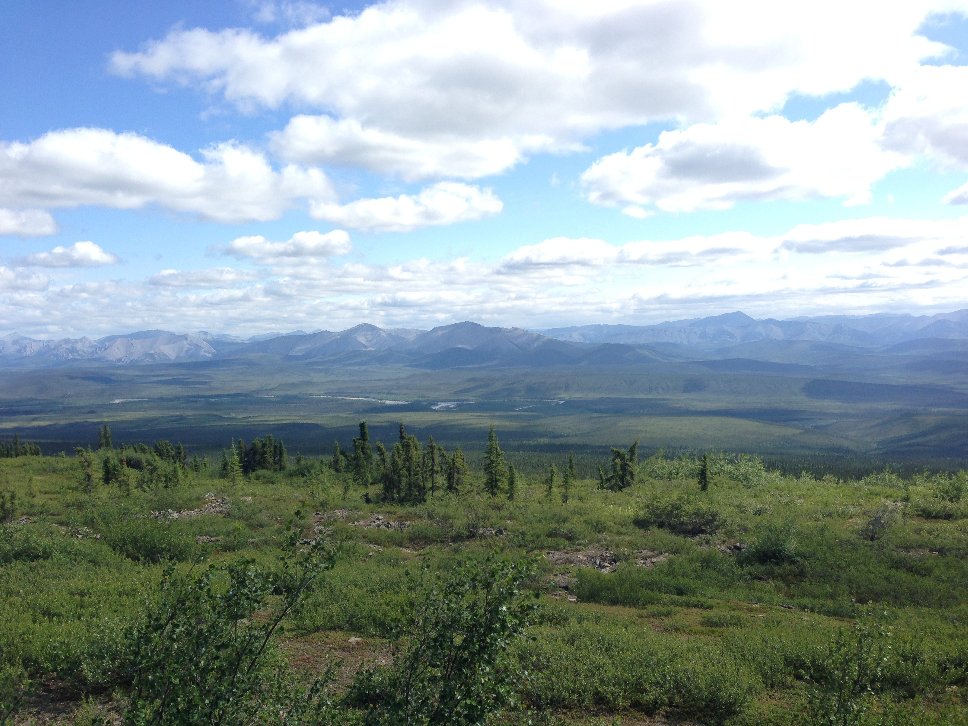
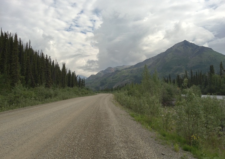
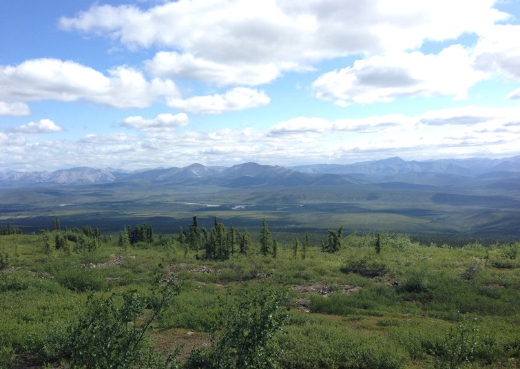
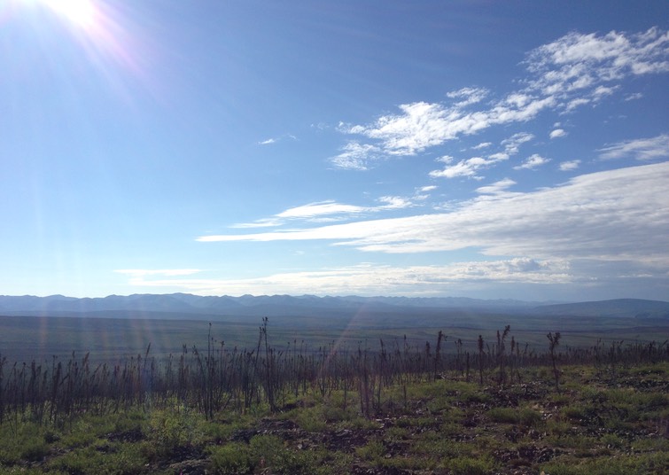
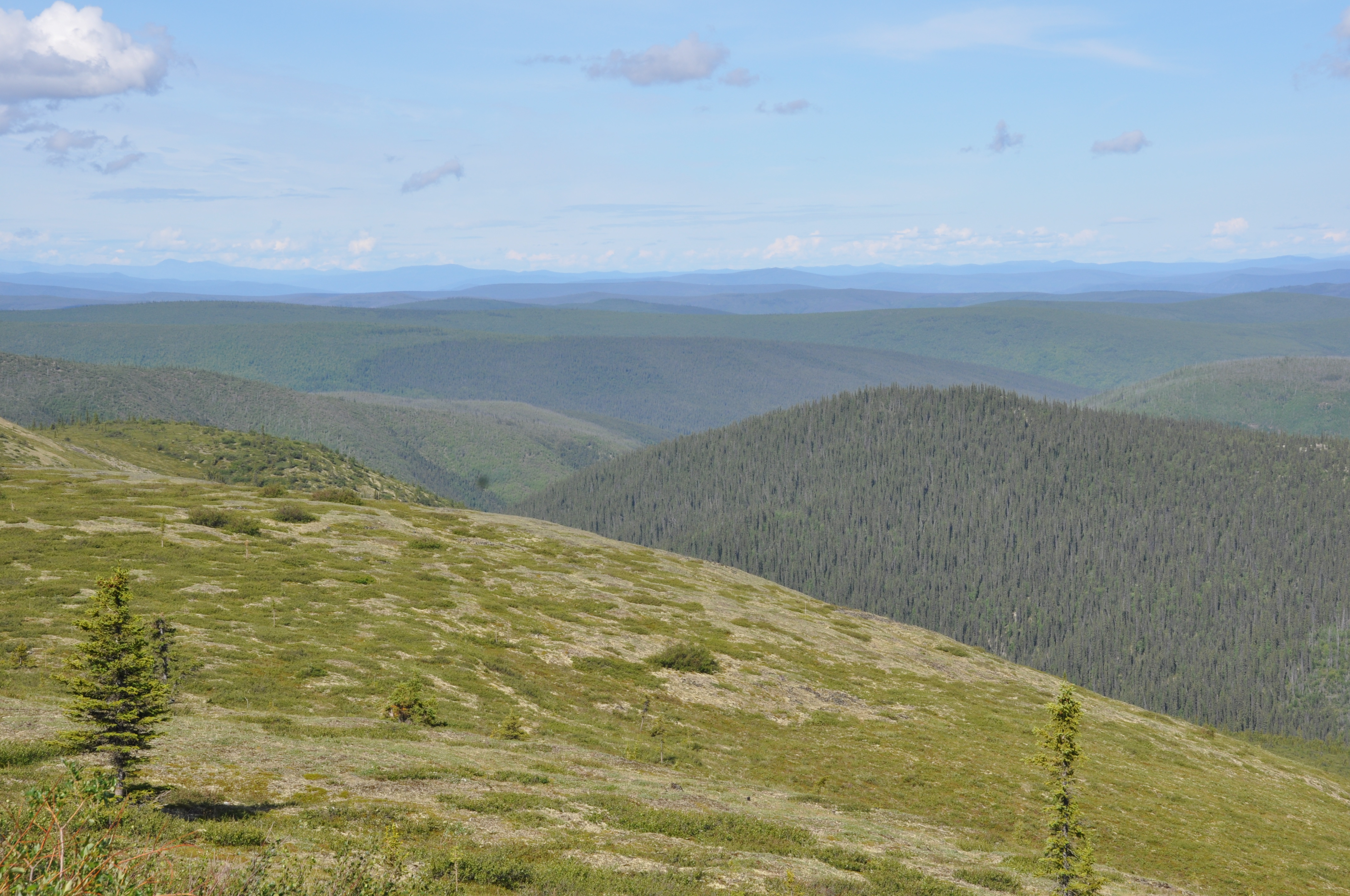
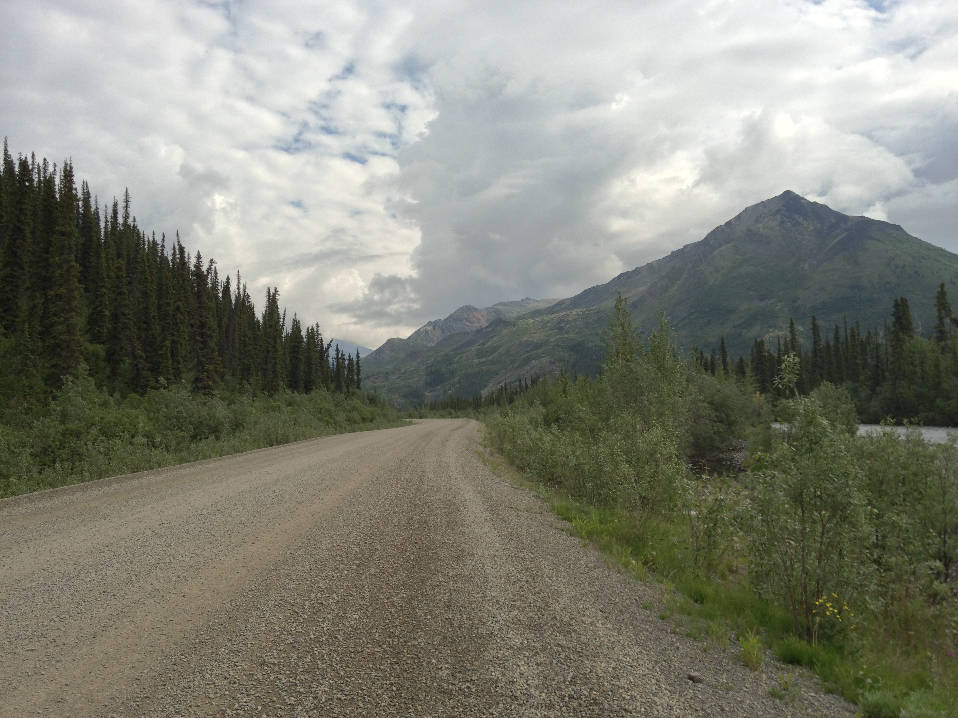
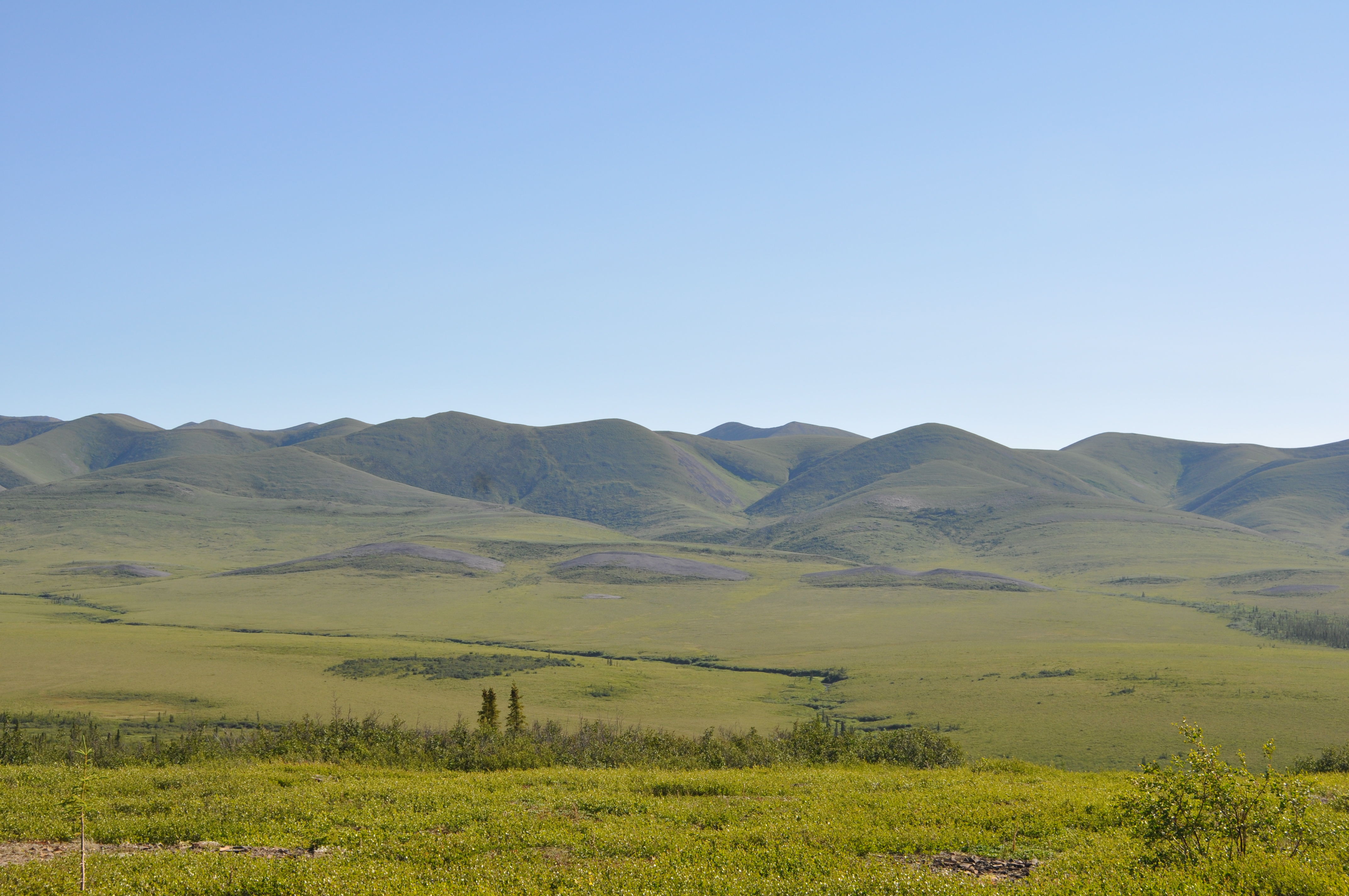
The drive to Inuvik can be done in one day if you set out early and keep stops to a minimum, but two days allows for a more leisurely trip with lots of time for photo ops and enjoying the scenery. Throughout the journey, the highway moves above and below the tree line, through barren tundra and pine-scattered taiga landscapes. The road is lined with fascinating rock formations and dolomite mountains, and stunning views over river valleys and distant mountain ranges. After the Tombstone range, the highlight of the first day’s drive is probably the Ogilvie River valley, along which the highway travels during the later part of the day. There is one particular rest area at the Ogilvie Ridge viewpoint, which lives on in infamy as the spot at which, twenty years ago, I spent several hours in a truck with two flat tires, while my husband hitched a ride to Eagle Plains, and then hitched back again, tires duly repaired.
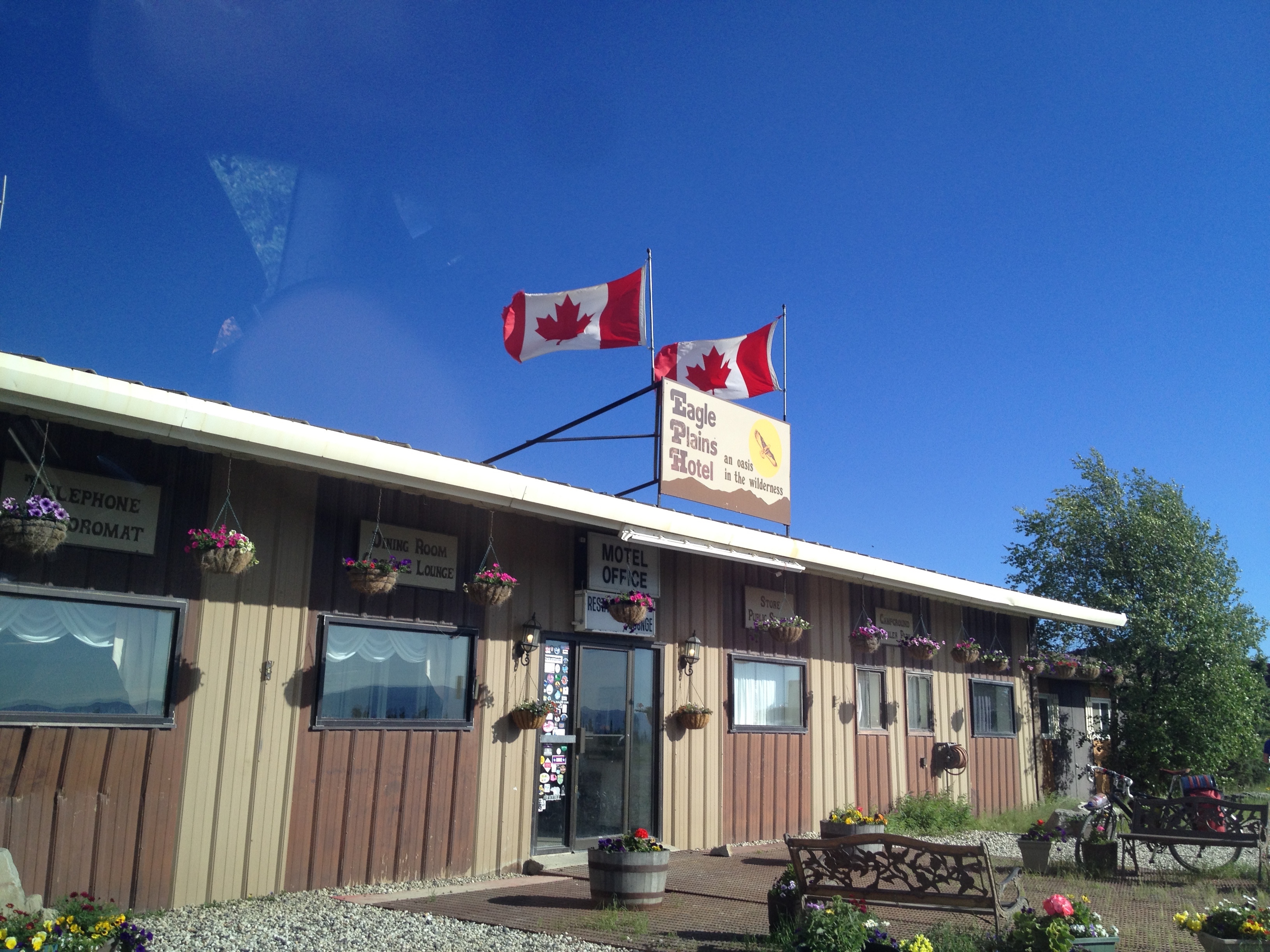
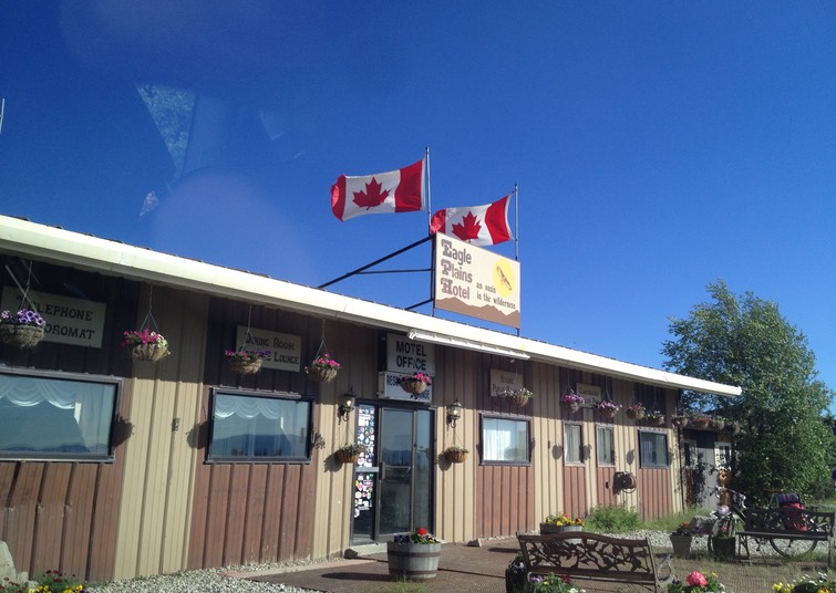
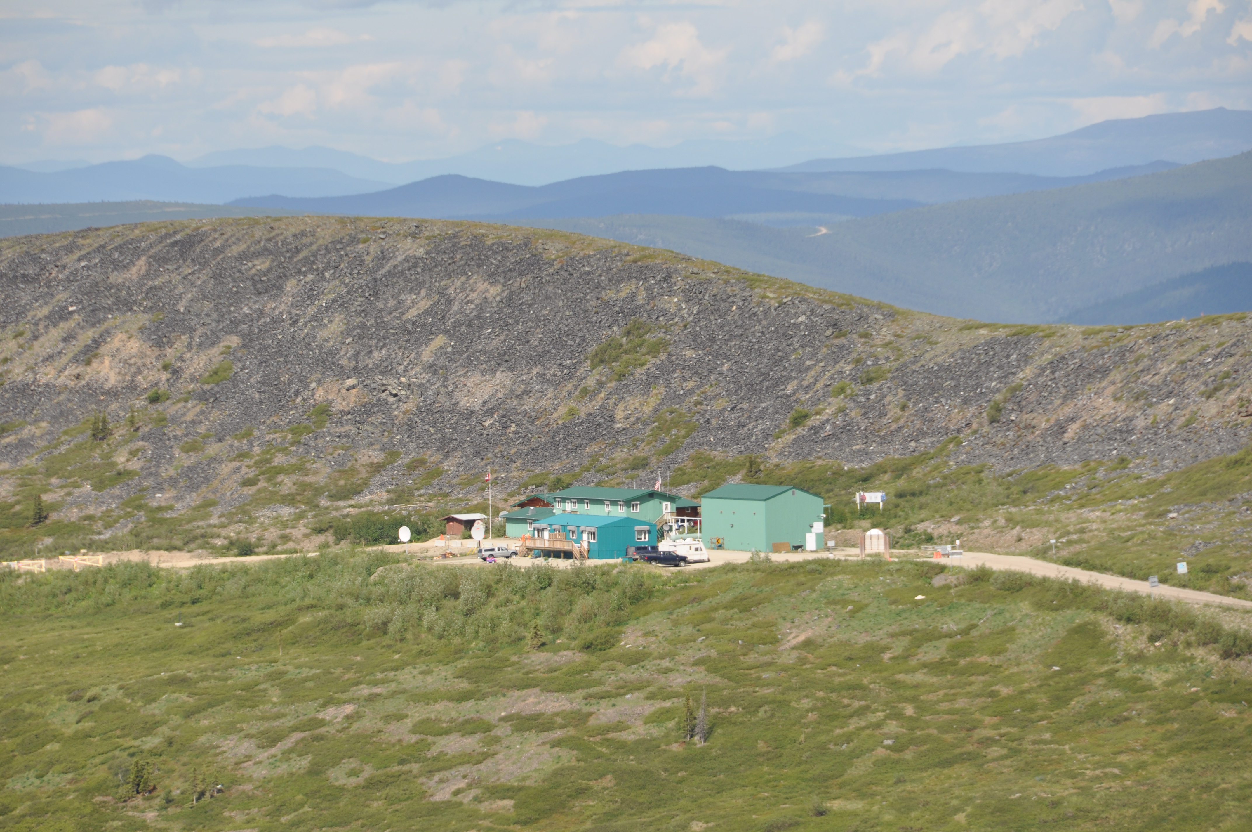
Eagle Plains is the stopover, almost two-thirds of the way to Inuvik, with a full-service garage and a small motel/restaurant. It sits on a ridge high above the eponymous plain, with lovely views when the sun is shining. Twenty years ago, on a tight budget (even tighter after money spent on repairing tires), we camped outside in an ancient, highly water-permeable tent. After rain proceeded to pour on us during the night and a high wind made matters worse, we packed everything up and waited in the truck for the restaurant to open in the morning. I have a vivid memory of sitting inside that restaurant having a warm breakfast, a pair of vegetarians surrounded by stuffed and mounted animals of every description!
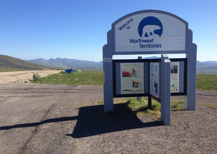
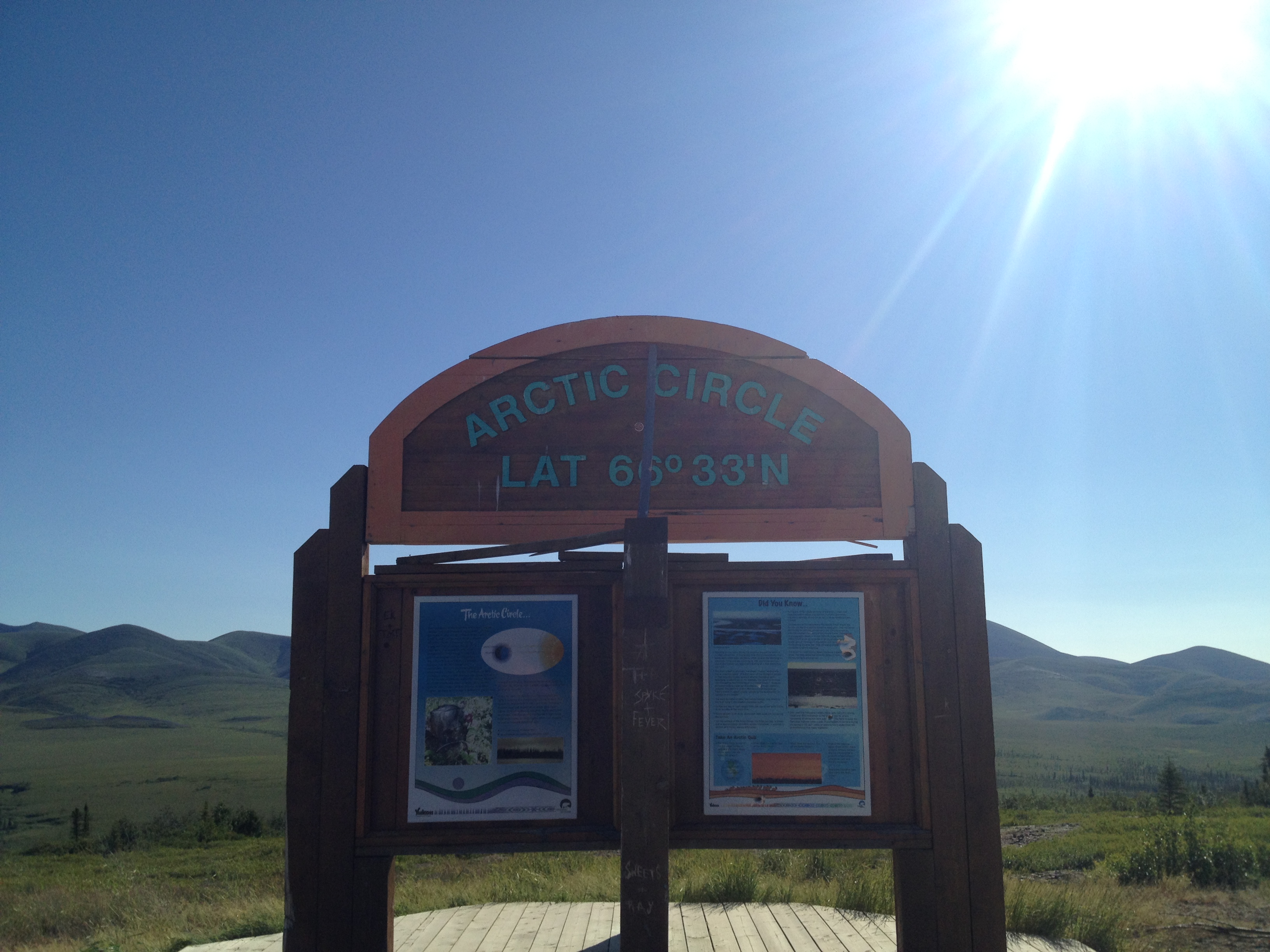
This time around, we slept in the hotel rather than next to it, and had both dinner and breakfast in the restaurant. It was pretty good considering the remote location, and there were vegetarian options and comfy beds, in which we slept well and awoke to a brilliant sky and lovely view. Twenty years ago, at this point in the journey, it snowed on us, but this time the day was stunning. After the Arctic Circle marker and its views of the distant Richardson Mountains, we drove across the tundra to the border of the Northwest Territories. By now, it really feels that you have left the regular world far behind. The surroundings are vast, nature feels big and wild, and people small and few.
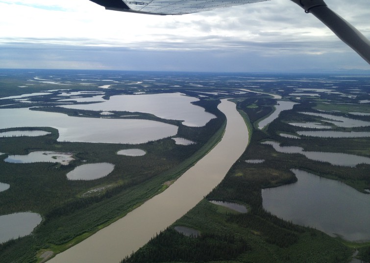
This part of the journey is dominated by rivers, the Peel and the Mackenzie. In winter, these are crossed by ice bridge, and in summer by ferries (for a few weeks every year during breakup and freeze up, the rivers are impassible). A cable ferry pulls itself back and forth across the Peel, near the Gwich’in community of Fort MacPherson. Further along, at the confluence of the Arctic Red River and the Mackenzie, a motor ferry moves vehicles between three points, connecting the community of Tsiigehtchic with the highway (twenty years ago, this village was still known as Arctic Red River).
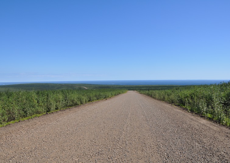
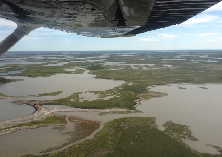
The final stretch of the drive passes through the Mackenzie Delta and its its boreal forest, taiga, and tundra. We were flooded with memories of twenty years past, and a wheel that pulled loose from the truck and bounced off into the shrubs, necessitating another hitched ride, this time into Inuvik to the Arctic Esso garage, where they had to keep the truck for three days while they airlifted new bolts in from Edmonton (it was neither a Chevrolet nor a Ford, which was all they were equipped to accommodate!). This time, however, everything stayed attached.
The highway ends rather abruptly, as you near Inuvik and suddenly find yourself back on pavement just before passing the Inuvik airport. This little frontier town marks the ending of one of the most spectacular highways in the world.
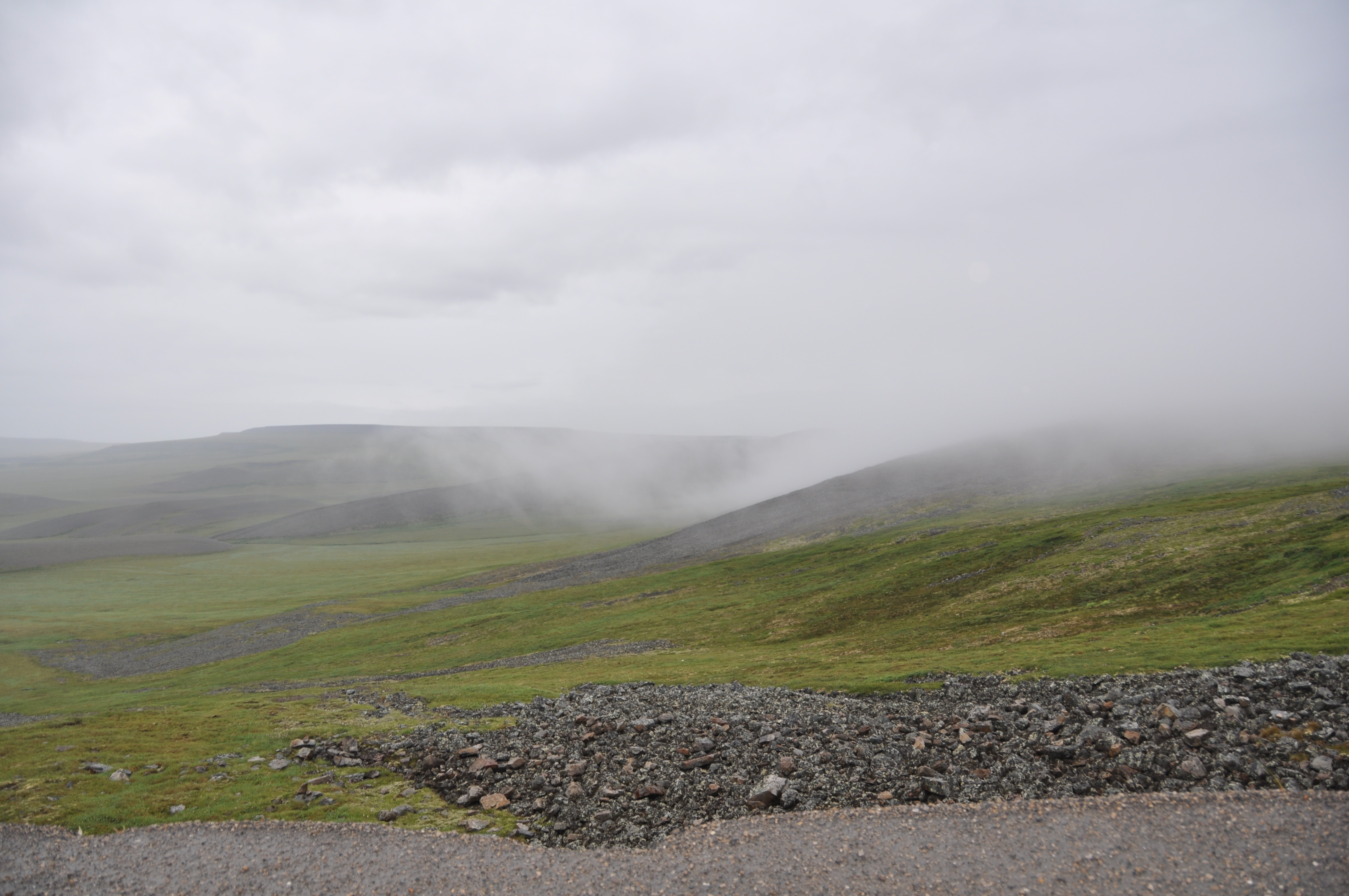
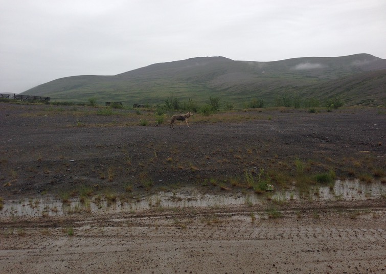
Photos: the Dempster Highway; start of the highway; Ogilvie Mountains; Tombstone Territorial Park; Ogilvie River Valley; Eagle Plains Hotel; Arctic Circle; tundra; Mckenzie Delta; tundra in the fog (Photos 3,6,7 B. Wilkes; photo 5 N. Wilkes)
What We Saw in the Arctic
The western Canadian Arctic is a panorama of glorious vistas and small but vibrant communities. Here is a small sample of what we saw.
What We Saw Along the Dempster Highway
Our drive up the unpaved Dempster Highway between Dawson City, Yukon, and Inuvik, Northwest Territories, revealed Canada’s north in all its glory, remote, varied, and awe-inspiring. This is a tiny selection of the photos we took on this memorable drive.