The last frontier still exists. It isn’t necessary to travel to outer Mongolia, or the Amazon, or subsaharan Africa, to experience it. All that is necessary is a commercial flight to Whitehorse, Yukon, and a rental car. After that, all you need to do is drive north. Dawson City, the “hub” of northern Yukon, is visited during the summer by many people- RVers from Alaska, tour buses from the Alaskan cruise ships, and visitors from southern Canada. But remarkably few take the trip to its northern conclusion; remarkably few tackle the Dempster.
The unpaved highway stretches north from Dawson, passing into the Northwest Territories and across the Arctic Circle, over mighty river systems and through northern mountain ranges, and concluding (for now, at least) at the town of Inuvik. This is one of the most spectacular drives you will ever take, and every Canadian should do it. Sadly, only a tiny few ever will.
We have been fortunate enough to do the drive twice: the first time, twenty years ago, newly married, adventurous, and naïve; the second this year, equipped with teenage son, plenty of money, and a reliable and road-appropriate vehicle. I wouldn’t have missed either experience.
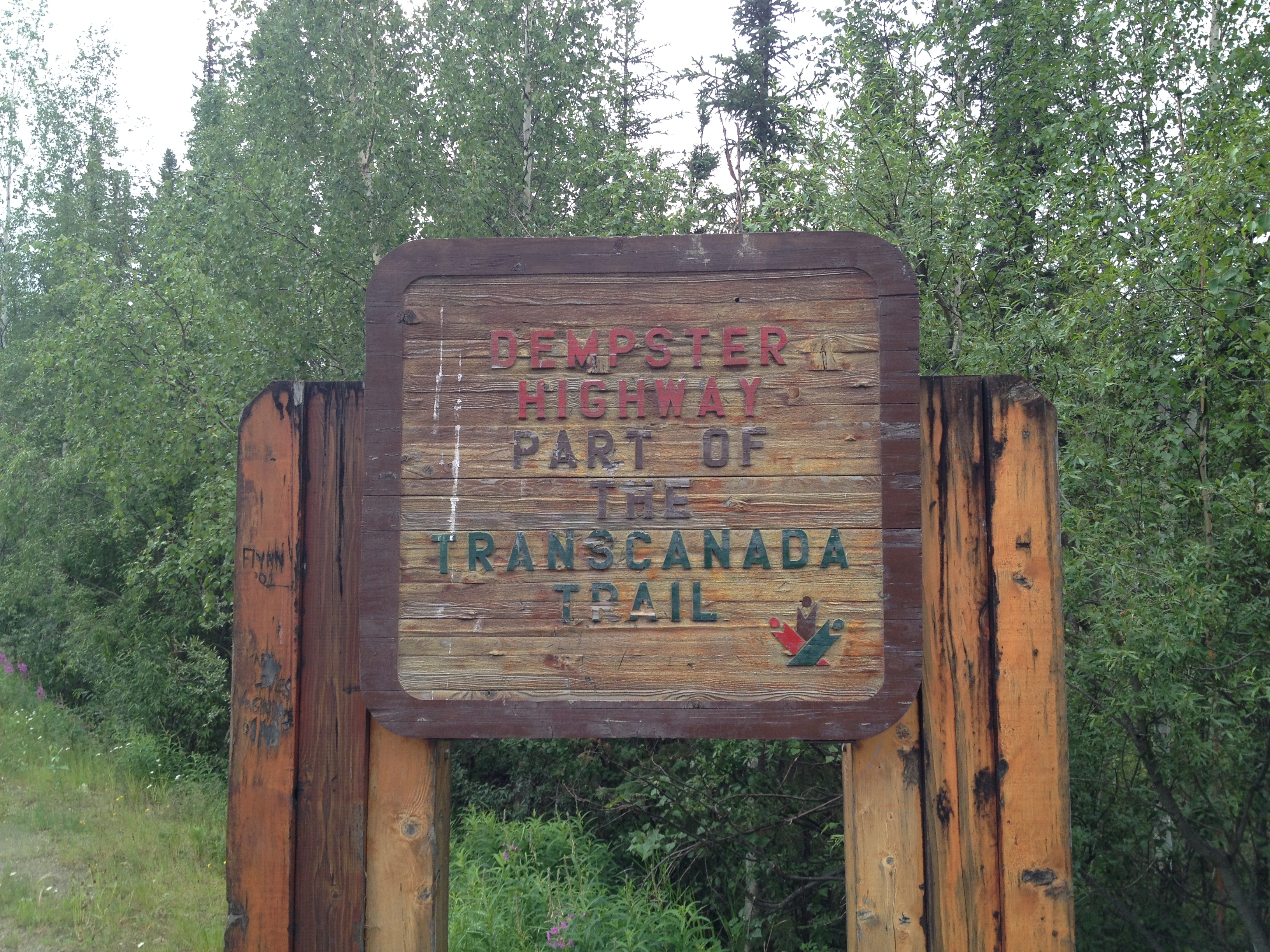
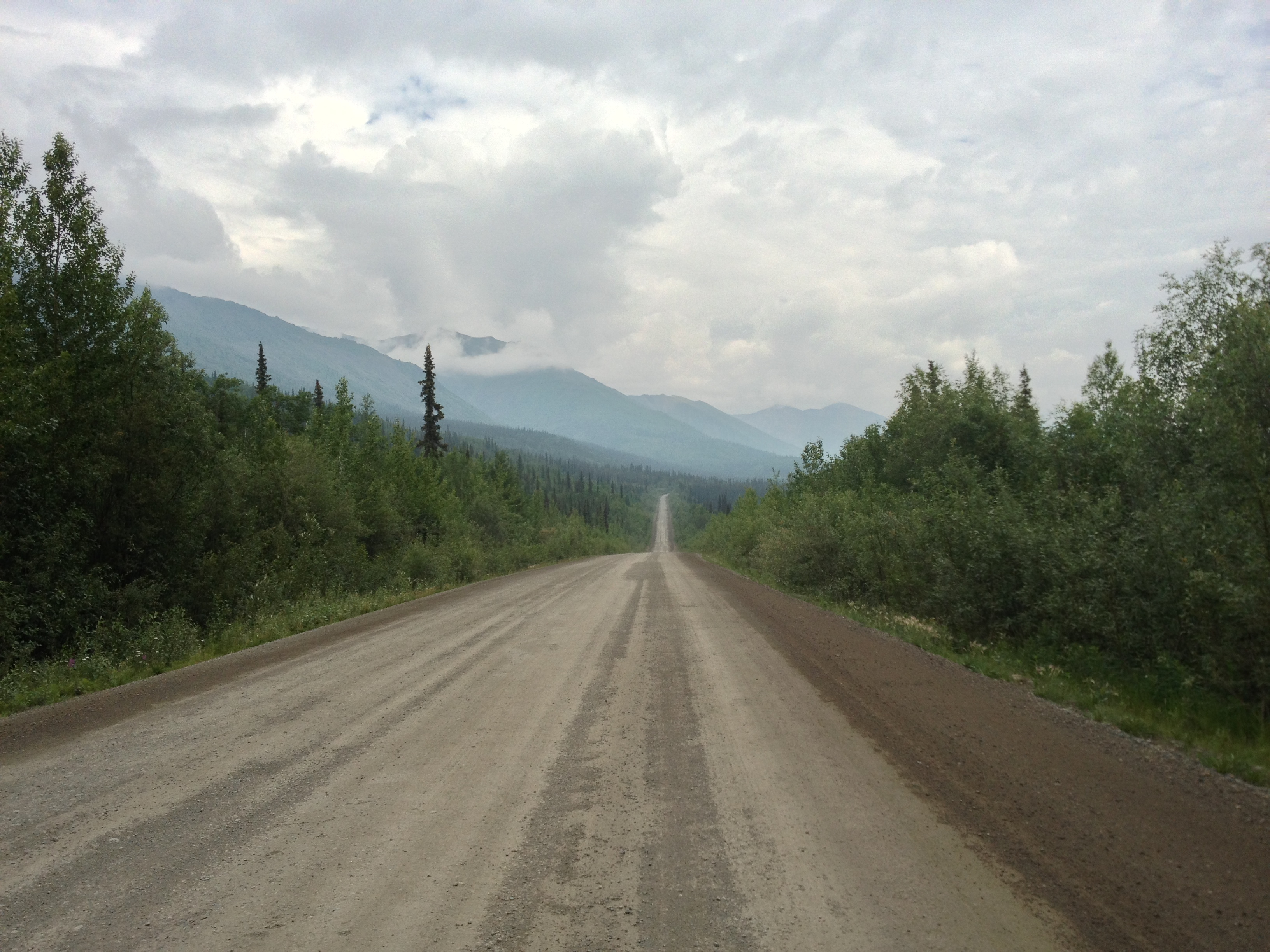
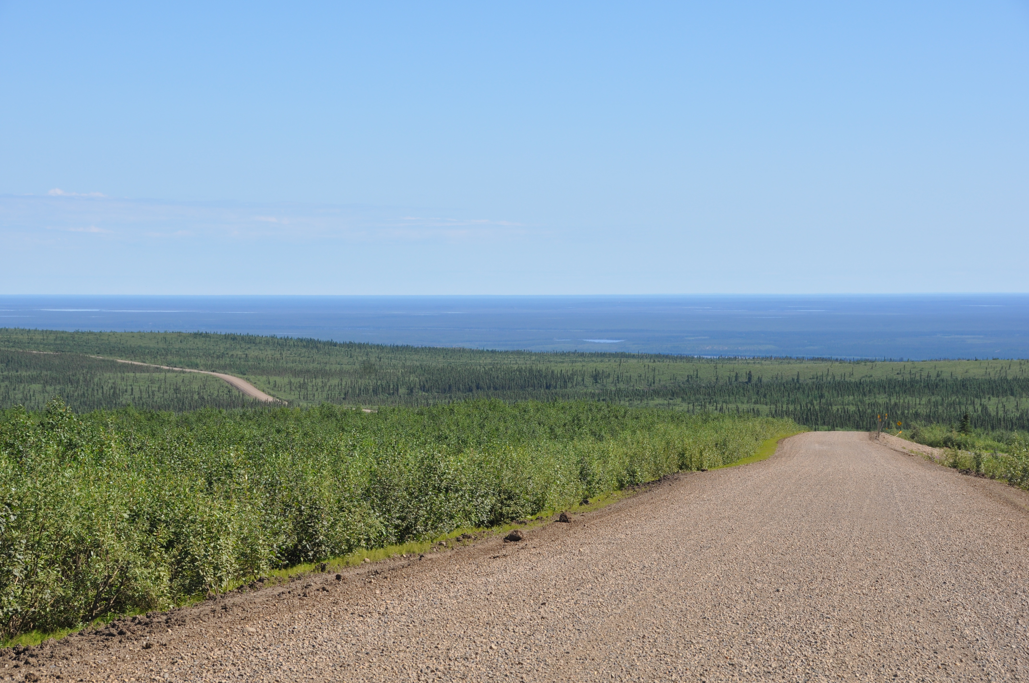
There is an instant magic when you turn off the highway outside of Dawson and cross the small bridge over the Klondike River, where a wooden sign proclaims the beginning of the adventure. After a few last metres of pavement, the car hits gravel and you are on your way. This narrow ribbon of unpaved road, currently winding its way along the bubbling Klondike through black spruce and willow shrubs, will take you through mountains, past plains, and over rivers, through tundra and taiga. You will see snow at some point along the way, and you will almost certainly experience rain and mud (if you don’t, you can hardly be said to have experienced the Dempster properly!).
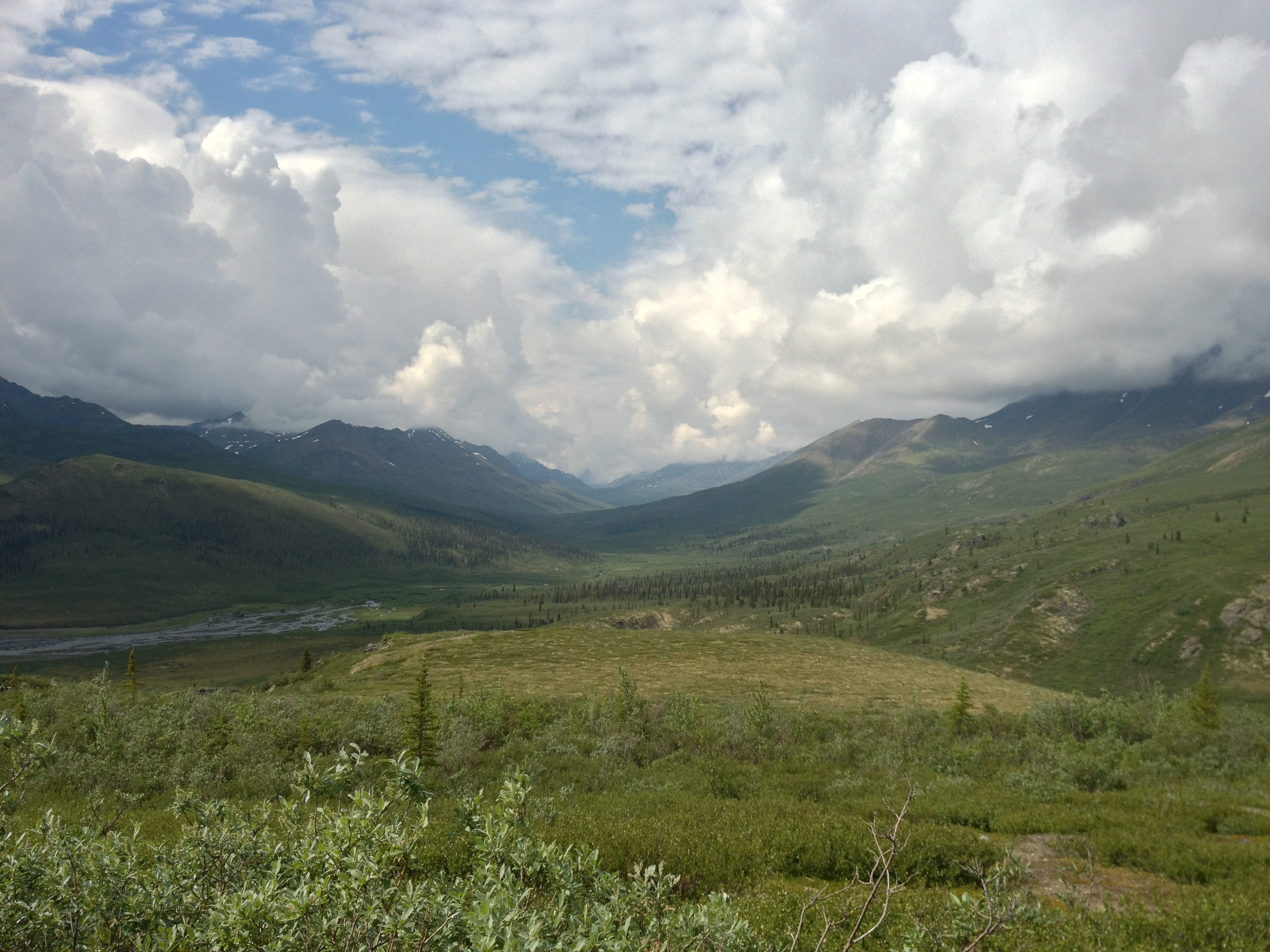
What you will not see in abundance is people. When you pull in for a rest stop, you will encounter a few fellow travellers, but even these become fewer once you have passed the interpretive centre at the Tombstone Territorial Park, which is an easy day trip from Dawson. The centre is relatively new and provides beautiful views out over the park, where a valley spreads back toward striking granite mountains.
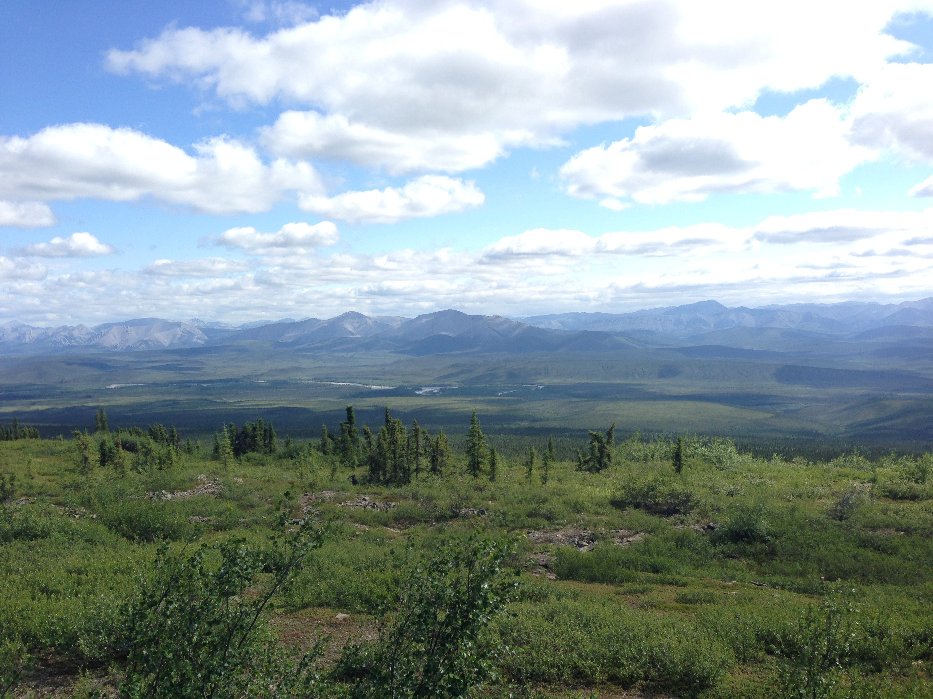
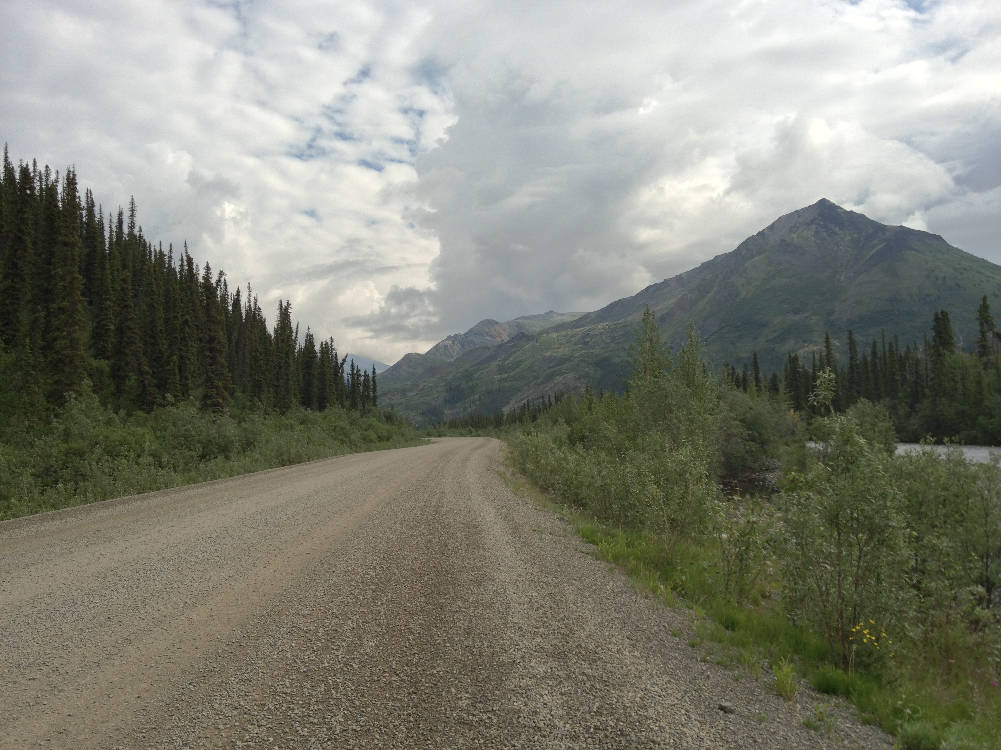
The drive to Inuvik can be done in one day if you set out early and keep stops to a minimum, but two days allows for a more leisurely trip with lots of time for photo ops and enjoying the scenery. Throughout the journey, the highway moves above and below the tree line, through barren tundra and pine-scattered taiga landscapes. The road is lined with fascinating rock formations and dolomite mountains, and stunning views over river valleys and distant mountain ranges. After the Tombstone range, the highlight of the first day’s drive is probably the Ogilvie River valley, along which the highway travels during the later part of the day. There is one particular rest area at the Ogilvie Ridge viewpoint, which lives on in infamy as the spot at which, twenty years ago, I spent several hours in a truck with two flat tires, while my husband hitched a ride to Eagle Plains, and then hitched back again, tires duly repaired.
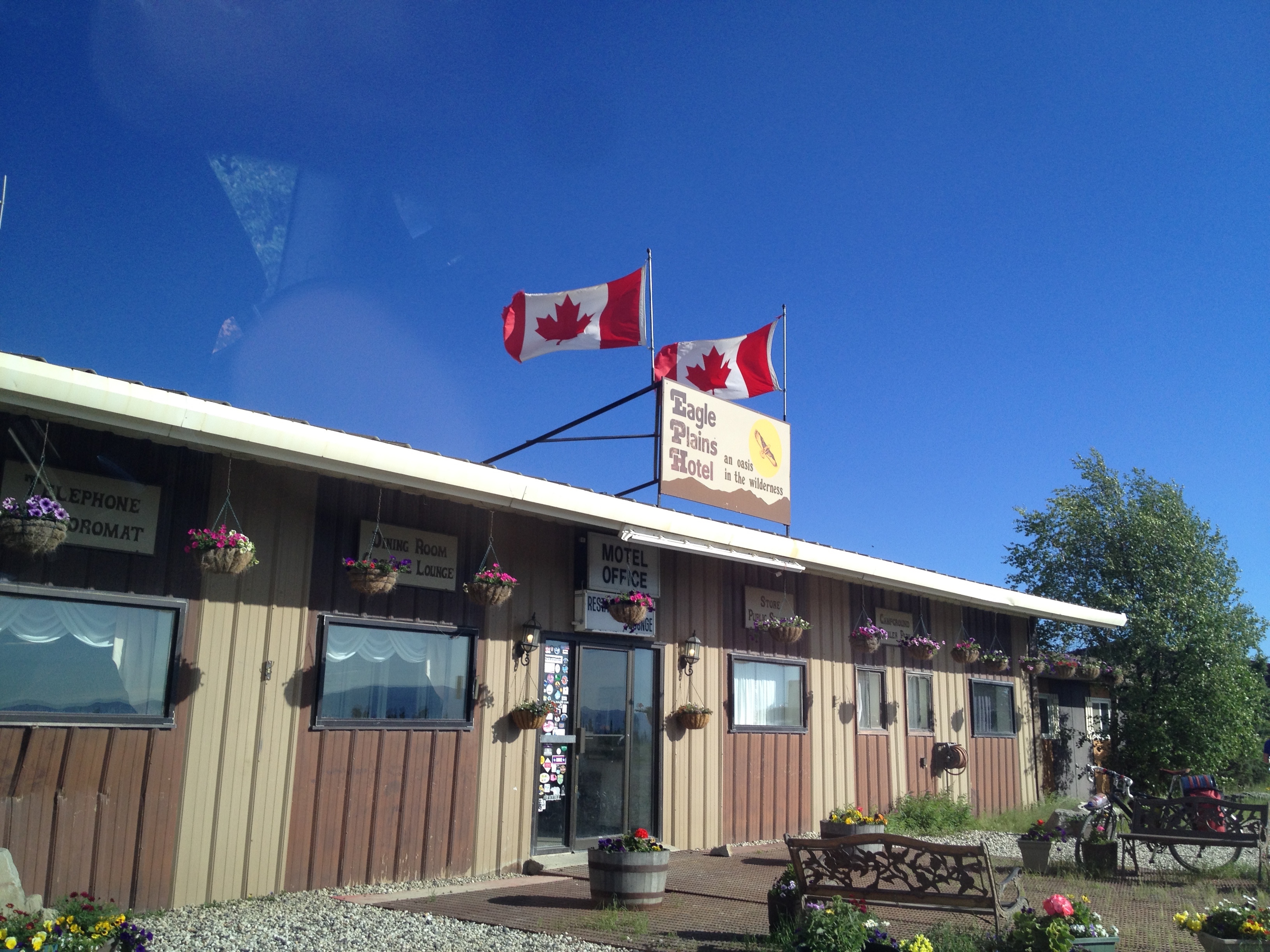
Eagle Plains is the stopover, almost two-thirds of the way to Inuvik, with a full-service garage and a small motel/restaurant. It sits on a ridge high above the eponymous plain, with lovely views when the sun is shining. Twenty years ago, on a tight budget (even tighter after money spent on repairing tires), we camped outside in an ancient, highly water-permeable tent. After rain proceeded to pour on us during the night and a high wind made matters worse, we packed everything up and waited in the truck for the restaurant to open in the morning. I have a vivid memory of sitting inside that restaurant having a warm breakfast, a pair of vegetarians surrounded by stuffed and mounted animals of every description!
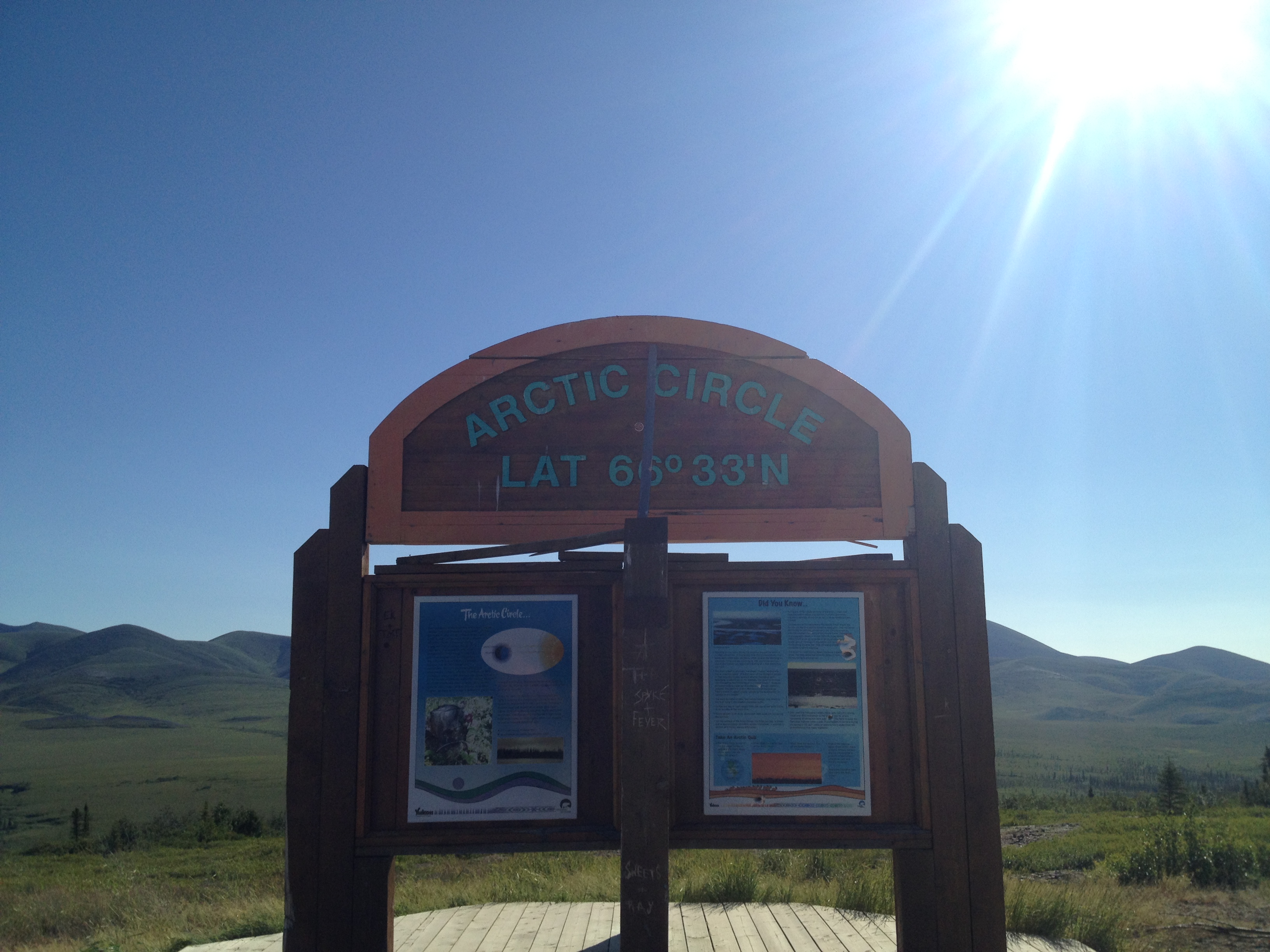
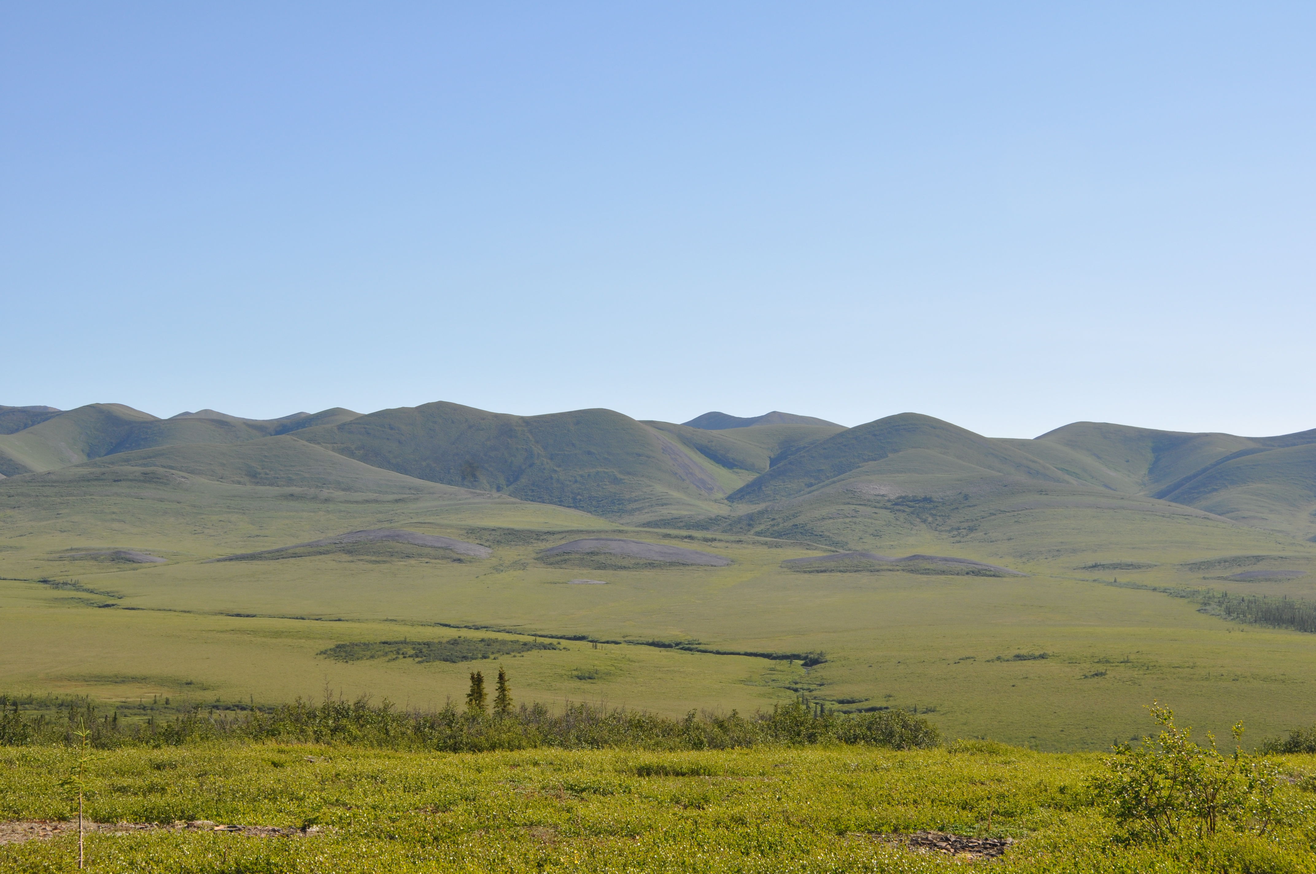
This time around, we slept in the hotel rather than next to it, and had both dinner and breakfast in the restaurant. It was pretty good considering the remote location, and there were vegetarian options and comfy beds, in which we slept well and awoke to a brilliant sky and lovely view. Twenty years ago, at this point in the journey, it snowed on us, but this time the day was stunning. After the Arctic Circle marker and its views of the distant Richardson Mountains, we drove across the tundra to the border of the Northwest Territories. By now, it really feels that you have left the regular world far behind. The surroundings are vast, nature feels big and wild, and people small and few.
This part of the journey is dominated by rivers, the Peel and the Mackenzie. In winter, these are crossed by ice bridge, and in summer by ferries (for a few weeks every year during breakup and freeze up, the rivers are impassible). A cable ferry pulls itself back and forth across the Peel, near the Gwich’in community of Fort MacPherson. Further along, at the confluence of the Arctic Red River and the Mackenzie, a motor ferry moves vehicles between three points, connecting the community of Tsiigehtchic with the highway (twenty years ago, this village was still known as Arctic Red River).
The final stretch of the drive passes through the Mackenzie Delta and its its boreal forest, taiga, and tundra. We were flooded with memories of twenty years past, and a wheel that pulled loose from the truck and bounced off into the shrubs, necessitating another hitched ride, this time into Inuvik to the Arctic Esso garage, where they had to keep the truck for three days while they airlifted new bolts in from Edmonton (it was neither a Chevrolet nor a Ford, which was all they were equipped to accommodate!). This time, however, everything stayed attached.
The highway ends rather abruptly, as you near Inuvik and suddenly find yourself back on pavement just before passing the Inuvik airport. This little frontier town marks the ending of one of the most spectacular highways in the world.
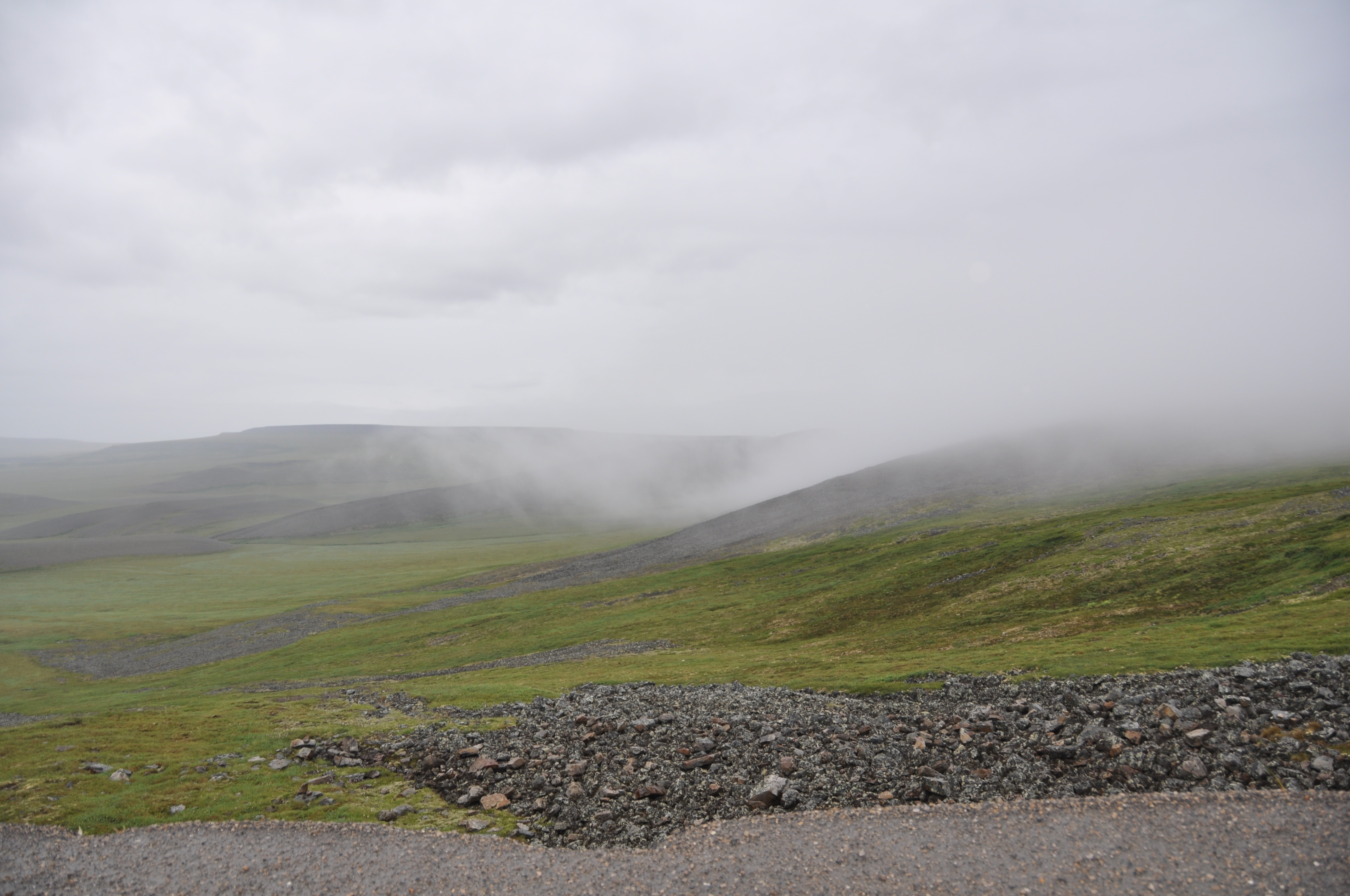
Photos: the Dempster Highway; start of the highway; Ogilvie Mountains; Tombstone Territorial Park; Ogilvie River Valley; Eagle Plains Hotel; Arctic Circle; tundra; Mckenzie Delta; tundra in the fog (Photos 3,6,7 B. Wilkes; photo 5 N. Wilkes)